
We are finally out of the desert! When I last left you, we were in Tehachipi, headed out into the driest and most miserable stretch of the trail. We spent seven hot, dry and exhausting days hiking to Kennedy Meadows.
I don’t have much else to say about it. Our packs were weighted down with loads of water. We’d be up by 4 a.m. to hike in the cool of the morning, before the sun beat us down, rest in what little shade we could find for the hottest part of the day, then hike till dark. Just trying to get through it.
But we made it to Kennedy Meadows–considered a big deal, as it means we hiked over a quarter of the trail, and we end Southern California and begin the High Sierras – where all the fun starts!
Most hikers hang out at Kennedy Meadows General Store, where you can camp, use an outdoor shower, port-a-potties, and work your way through the very long line for the one washing machine, and dry your clothes on the line out back. There is a grill that cooks lunch and sometimes breakfast, and a pick up truck that carts loads of hikers to Grumpy’s Restaurant down the road for dinner, drinks, and all-you-can-eat pancake breakfasts.
We ended up staying for two zeroes, since our crew of hiker friends has gotten behind us, because they’d resupplied in a town we bypassed. Unfortunately, they wanted to take an extra zero as well (KM has a weird way of sucking you in). We couldn’t handle yet another day there, so we moved on without them, but it was nice to reconnect for a bit and we’ll see each other again.
Not a Desert
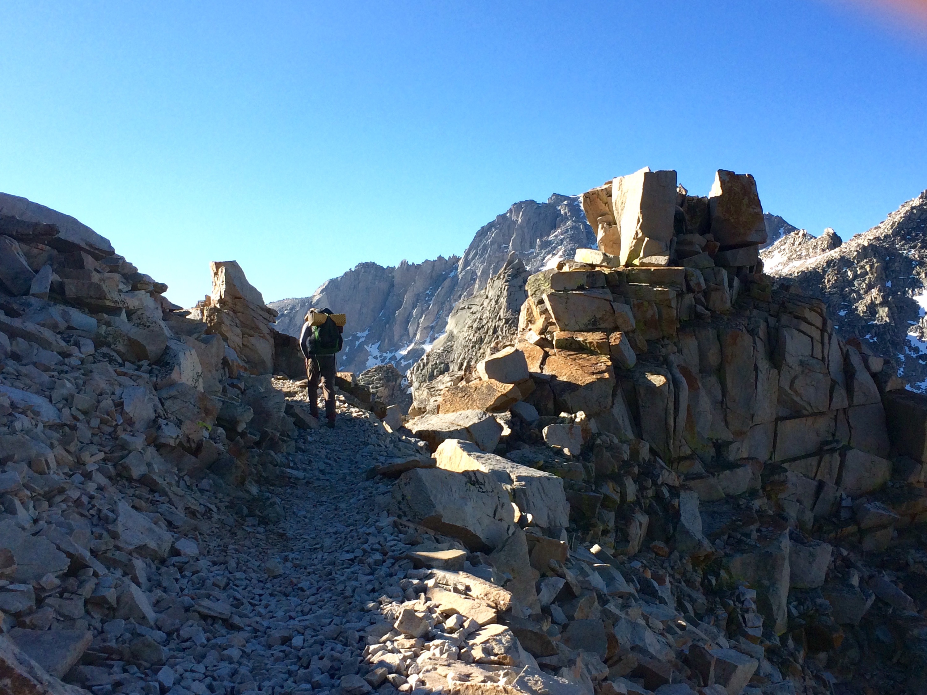
After Kennedy Meadows, it was as if it was a new trail. The desert just did not jive with my soul, but it is definitely gettin’ down with the Sierras. This trail is the one I’ve been dreaming of –gorgeous valleys, alpine meadows, lakes, streams, waterfalls, giant trees, crazy mountain peaks, just amazing! We enter Sequoia and King’s Canyon National Parks.
But it has not been without its challenges. We’ve been rained, hailed, or snowed on for 4 of the 7 days of this stretch. We’re also spending most of our days and nights at higher elevations than anything on the East Coast.
Mt. Whitney, the highest peak in the contiguous U.S., at 14,505 feet, is in this stretch. It’s not part of the PCT, but most hikers do this popular side trail. Our plan was to camp a few miles up the trail, then summit in the morning. But of course, plans are made to be broken (especially on the PCT). We hiked to our planned camping spot, on Guitar Lake, in the snow with a little bit of thunder. We set up our tent in record time!

what we hiked into, another hiker, Sas’s tent in the snow, Guitar Lake

what we woke up to

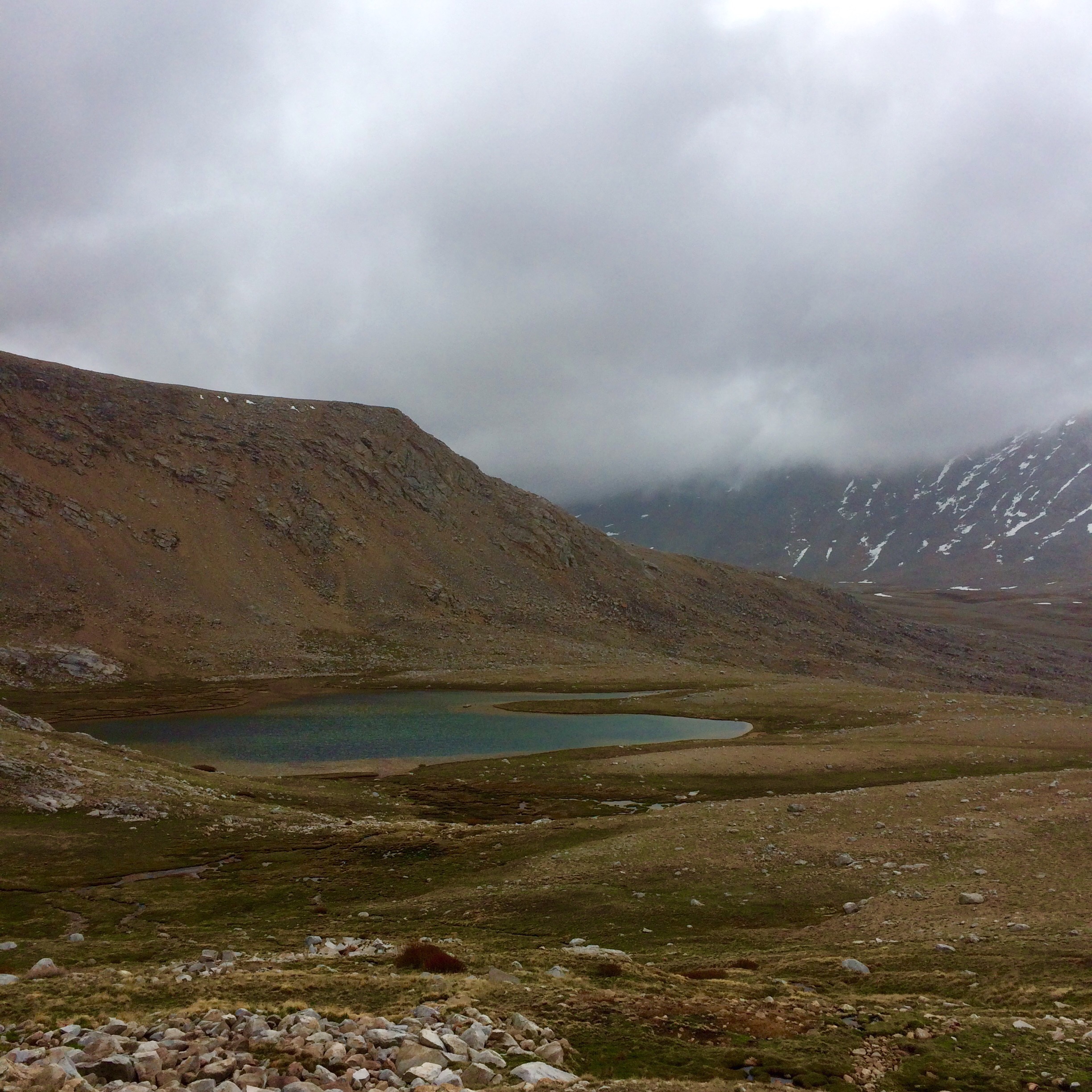
view of Guitar Lake from Mt Whitney trail

more stunning views
The next morning, it had stopped snowing, much of it had even melted. There was patches of sunlight hitting the peaks, unfortunately not the peak we wanted to climb. Whitney was shrouded in clouds, but we decided to give it a go anyway. The hike up to the clouds was some of the most beautiful scenery I’d ever seen. Then we hit clouds, and snow, coupled with elevation, very slow climbing. We made it up to the ridge crest, only another 1.9 miles to summit, but the trail was getting a bit treacherous with the new and old snow.

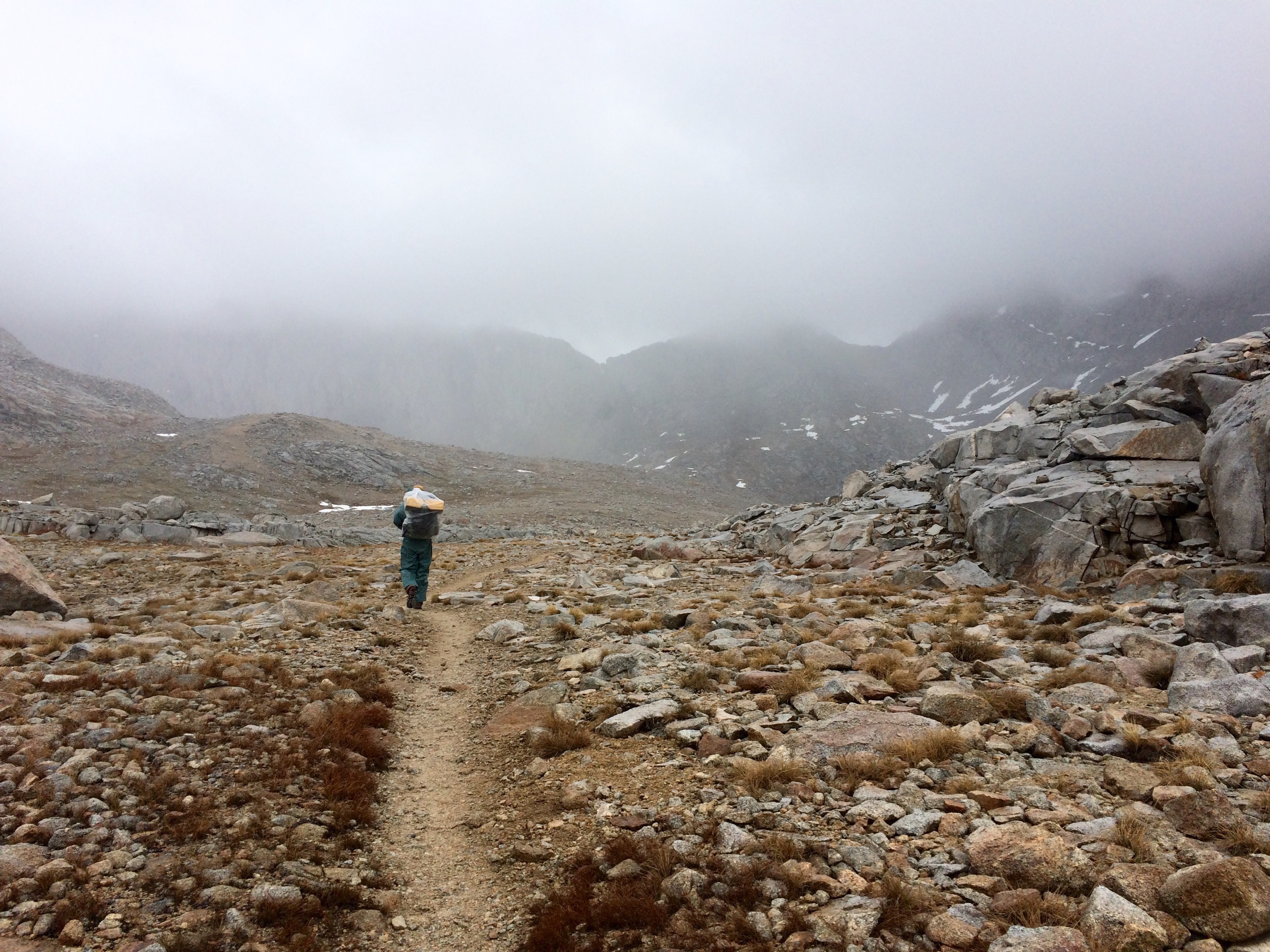
headed up the Mt. Whitney trail in the clouds
We had a decision to make –to summit or not. This brought up some interesting questions about why one chooses to summit a mountain anyway. I realized for me, that breathtaking view you get at the top is the biggest reason, and that wasn’t happening today. The summit was going to look just like the spot we were standing in. We ultimately decided it wasn’t worth it, today was not our day, but just getting that far was still pretty great, at 13,500 feet the highest we’d ever been.
So we hiked back down, ate lunch, dried everything out in the sun, and got back on the PCT, setting us up for Forester Pass in the morning. This night we managed to get our tent all set up before the rain started.

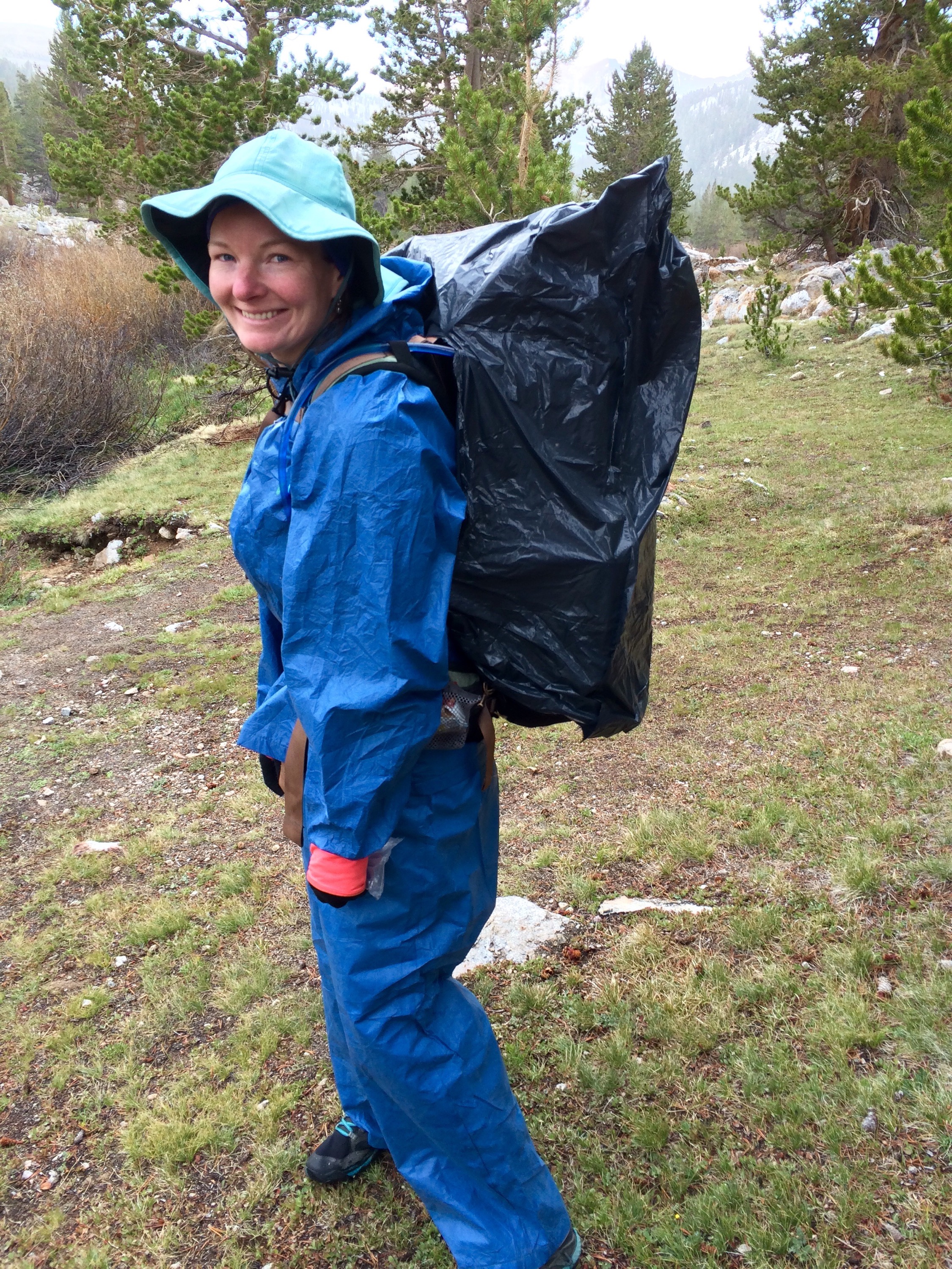
high fashion on the trail, matching rain gear
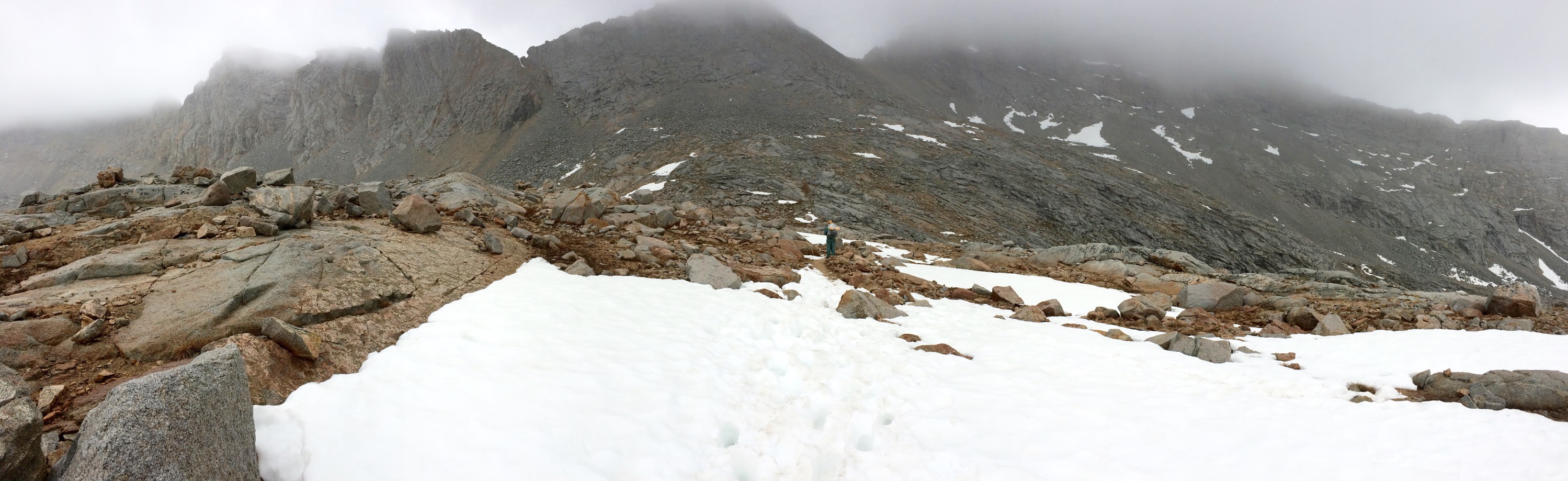
 The rain stopped sometime in the night, but then began again just as we started our hike the next morning, and didn’t stop. Then, as we approached Forester Pass (at 13,000 feet, the highest point on the PCT), the lovely alpine lakes were still frozen and the rain turned to snow.
heading to Forester Pass
the pass is somewhere up that rock wall in those clouds
Hiking up the pass is probably best described in pictures. It was crazy.
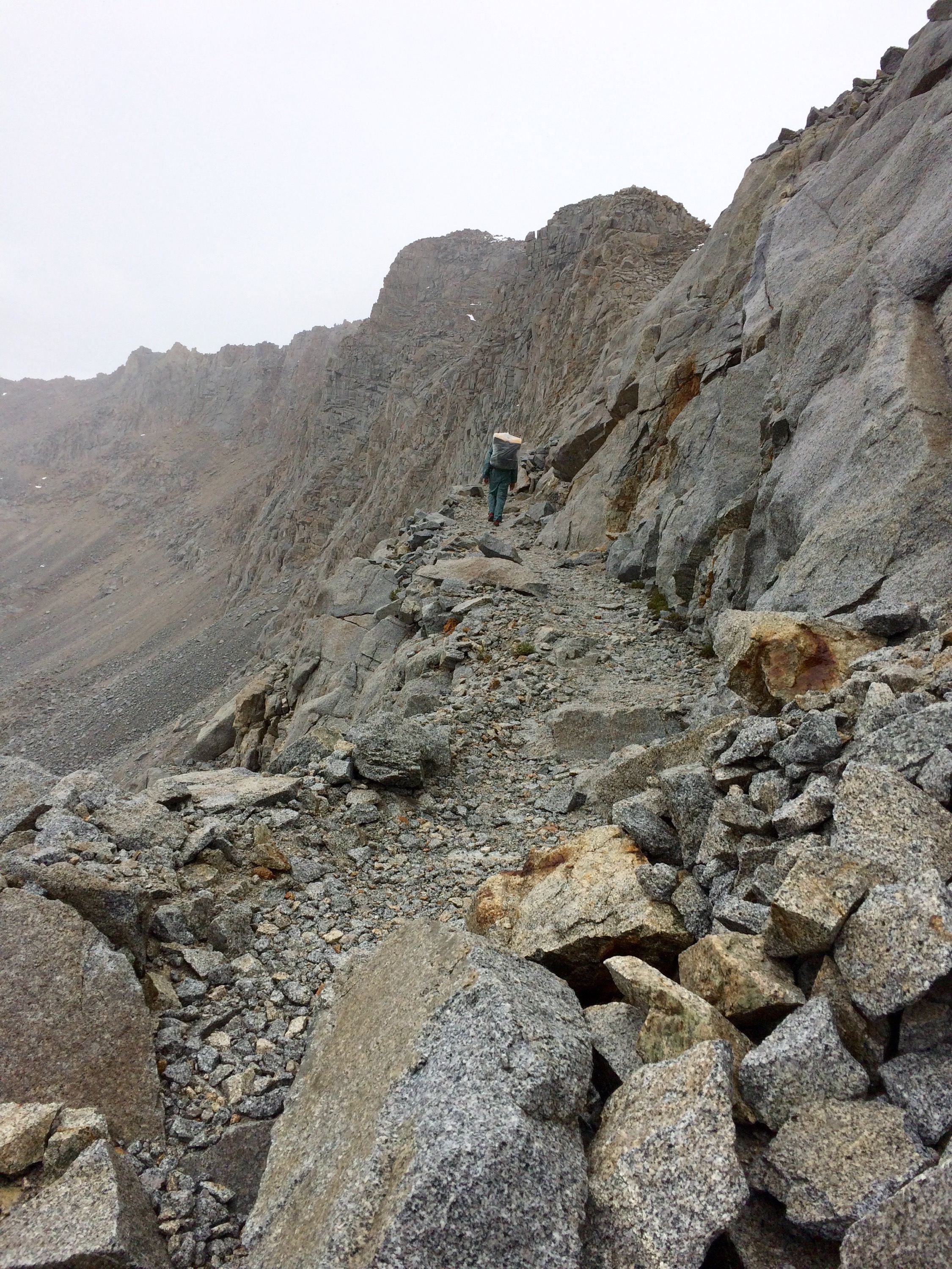
hiking up to Forester Pass

almost there, Jason bottom right, little dots on top of snow 2 other hikers
the pass from below
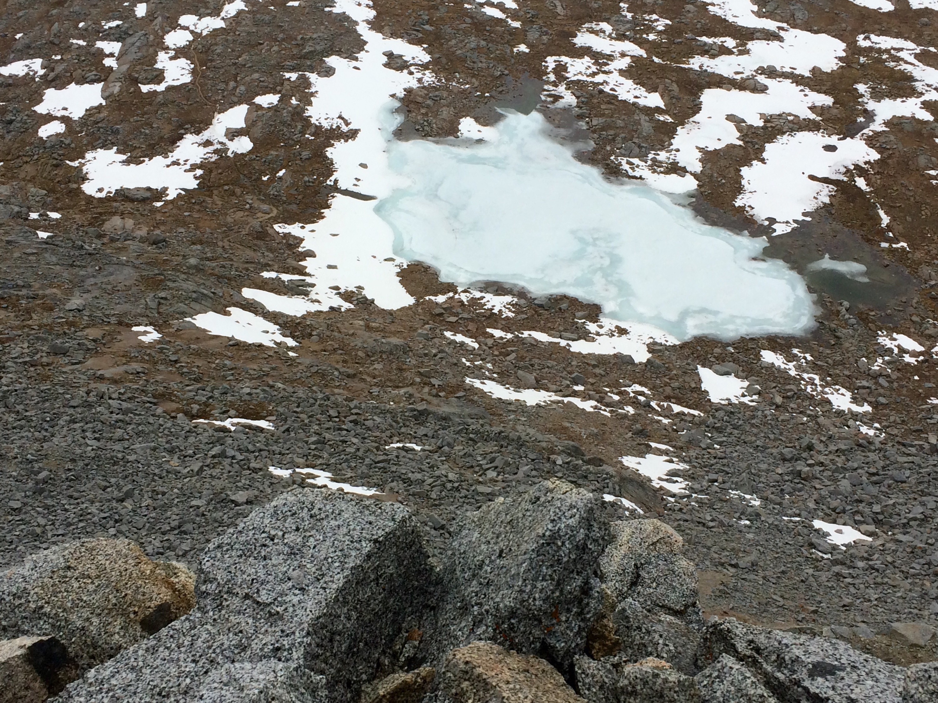
lake looking down from trail
Then we get to the top and share the experience and amazing view with 3 other hikers, 2 of whom are musicians. One whips out a mini guitar and they start singing a beautiful song about the PCT, that sounded like they just wrote it. It was a magical moment.
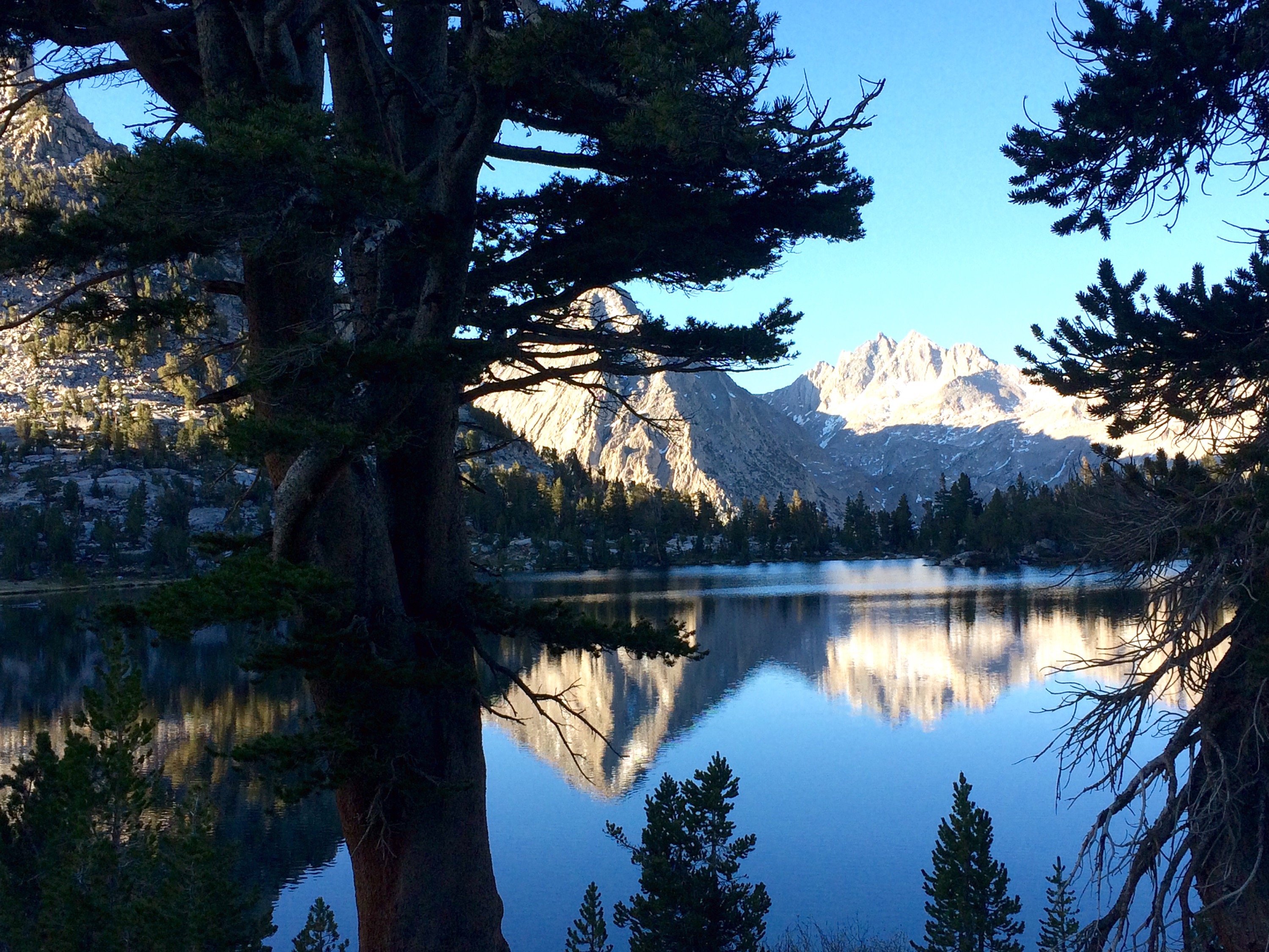
The rest of the day was filled with more breath-taking views. I felt like I was walking through a calendar all day. Everywhere you turned was a calendar-worthy view. I don’t even have to try, the photos take themselves.

sweet spot for a break, Bubb’s Creek
Then the sweetest end to this lovely day — a spaghetti dinner, the very meal I’d been craving for the past 2 days! We walk up to a campsite, greeted by a man with a brogue who shakes our hands and gives us a ziplock goodie bag of chips, granola bar, and cinnamon roll, and tells us there is spaghetti warming on the fire. Best trail magic yet! This crew hiked up with packs loaded with all this food to feed us hungry hikers for the weekend! They also had post cards for us to write on that they would mail. He has been doing this for the past 6 years.
you have entered into awesome trail magic
We hiked another 1.5 miles, and 900 vertical feet, fueled on spaghetti. Set up in a lovely little spot by one of the many streams and ate our trail dinner (yes, we’re that hungry!).
This set us up to take the 8 mile spur trail over another pass (Kearsarge, named after a mountain in New Hampshire, this one only 11,700 feet) and down into the town of Independence, where we then got a ride into the bigger town of Bishop to resupply, get clean, and recharge.
just the view on our morning stroll, happy little trees
headed up Kearsarge Pass

view of the other side, atop Kearsarge Pass
For those of you interested, I’ll post our daily mileages for these last two stretches. Tehachipi to Kennedy Meadows mileage was dictated by where we could find water, heat, and just generally wanting to get it over with, not without climbs, but flatter. Kennedy Meadows to Independence mileage depended on acclimating to high altitudes, steap rugged terrain, and setting up to climb Whitney and passes at the right time of day. Then getting out of and into towns are generally shorter days.
Tehachipi to Kennedy Meadows
Day 1: 20.8 miles
Day 2: 21 miles
Day 3: 15, hottest day, 5 hour siesta
Day 4: 27
Day 5: 19
Day 6: 22.5
Day 7: 10
Kennedy Meadows to Independence
Day 1: 13 miles
Day 2: 19
Day 3: 20.5
Day 4: 15
Day 5: 16, including some of Mt Whitney
Day 6: 14, Forester Pass
Day 7: 8
I’d love to do a Q&A post soon, so if you have any questions, ask away in the comments section and I’ll answer.
Headed back into the High Seirras tomorrow for another 10 days.
Happy and Hungry for more,
Comet
1,870 miles to go

June 13, 2015 at 8:11 pm
Did you have any fear going over the passes and on Whitney? High places are not my favorite thing and I wonder how scary the trail is.
LikeLike
July 1, 2015 at 3:43 pm
Brian, my husband is afraid of heights and he did experience it in Whitney and forester pass, but not the other passes
LikeLike
June 13, 2015 at 8:49 pm
I’ve left a number of summits to later times over the years. Some might have been life-savings and I’ve regretted none.
The Toyota’s running great btw.
LikeLike
June 13, 2015 at 9:07 pm
all of it is utterly amazing. the physical movement, your tales of other hikers, the trail magic and the wonderful breathing taking photos. I have to admit, I love this part of your trail. the beginning getting used to everything sounded rough and the desert- well it is a desert. I am also amazed on the number of hikers and those that work and help on the trail. what a unique world. love it. love you, too.
LikeLike
June 13, 2015 at 9:15 pm
All of your photos are magical but that one of Bubb’s creek is unreal! It looks like paradise.
LikeLike
June 13, 2015 at 9:52 pm
Thanks! It felt like paradise
LikeLike
June 13, 2015 at 9:30 pm
Catie, What amazing experiences you have had hiking the PCT! The photography tells the story that you will be telling well into your senior years. Happy trails to you…. Pam From: Going Wherever It Leads To: dsibeck@yahoo.com Sent: Saturday, June 13, 2015 3:36 PM Subject: [New post] A Tale of Two PCTs: Desert and Not a Desert #yiv9271909084 a:hover {color:red;}#yiv9271909084 a {text-decoration:none;color:#0088cc;}#yiv9271909084 a.yiv9271909084primaryactionlink:link, #yiv9271909084 a.yiv9271909084primaryactionlink:visited {background-color:#2585B2;color:#fff;}#yiv9271909084 a.yiv9271909084primaryactionlink:hover, #yiv9271909084 a.yiv9271909084primaryactionlink:active {background-color:#11729E;color:#fff;}#yiv9271909084 WordPress.com | yogacatie posted: “We are finally out of the desert! When I last left you, we were in Tehachipi, headed out into the driest and most miserable stretch of the trail. We spent seven hot, dry and exhausting days hiking to Kennedy Meadows. I don’t have much else to say a” | |
LikeLike
June 13, 2015 at 9:53 pm
Thanks Pam!
LikeLike
June 15, 2015 at 1:24 pm
i recently read “Wild” ,so it’s so interesting to hear your adventures in the PCT, too! I know I couldn’t do it, so I’ll live it through you! Keep moving and I can’t wait to hear more! And stay safe!!!
LikeLike