Quick post to let you know- they’re gone! So far anyway, we’ve been hiking 2 days, taking it slow, also mostly uphill (up to 8,200 ft), which is easier on them. But today’s downhill into town was pain free!
So here’s what I did: rested, iced, and stretched. I also had a great physical therapist appointment, big thanks to Mason at Pacific Pro PT in Irvine. I love physical therapists, they are the best. I chose to go that route because I felt a doctor wasn’t going to tell me anything I didn’t know, and a PT will tell me the how and why, and then how to fix it.
This is what I learned: somehow I had lost a lot of range of motion in my ankle, which is where the soreness started. So the muscle on my shin was having to do the work that the ankle joint should have been doing, hence all the pain. He gave me some exercises to do, and so far so good!
Now for the pics. Glad we took a couple extra days to wait out the storm, snow in the mountains. Hiked in some snow on the ground today and I think we’ll find more tomorrow going up Mt. Baden Powell.
Scenes from Jason’s solo days:
Joshua trees
sunset
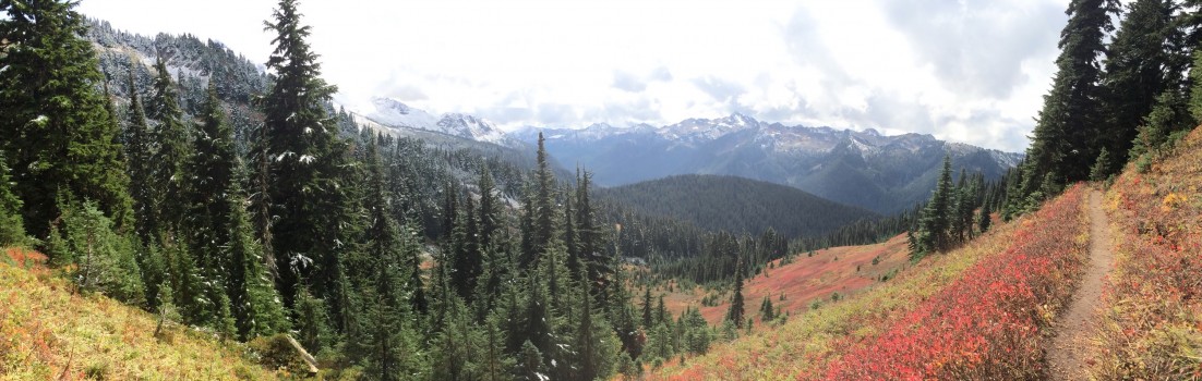
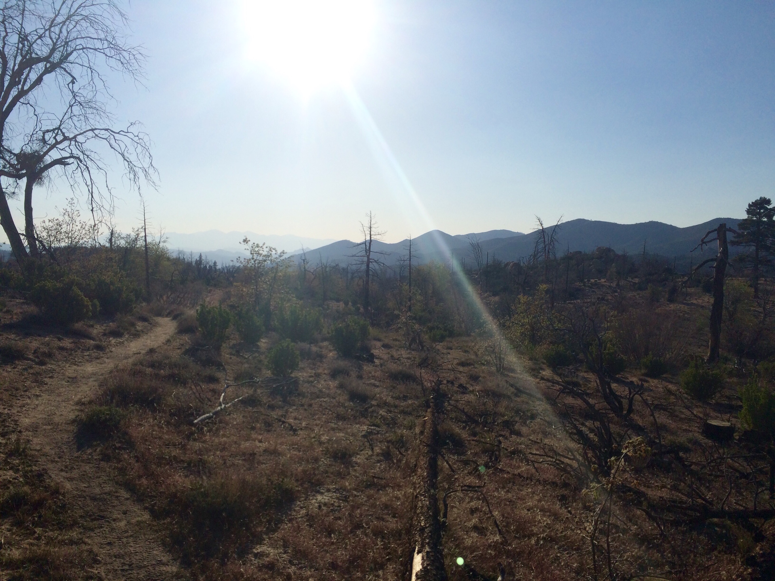
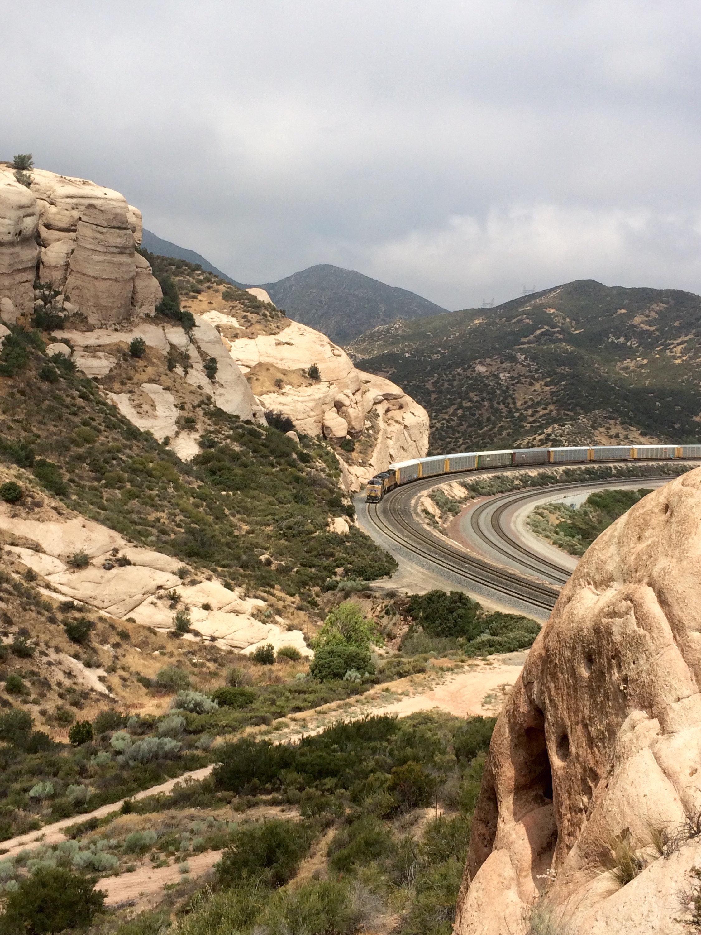
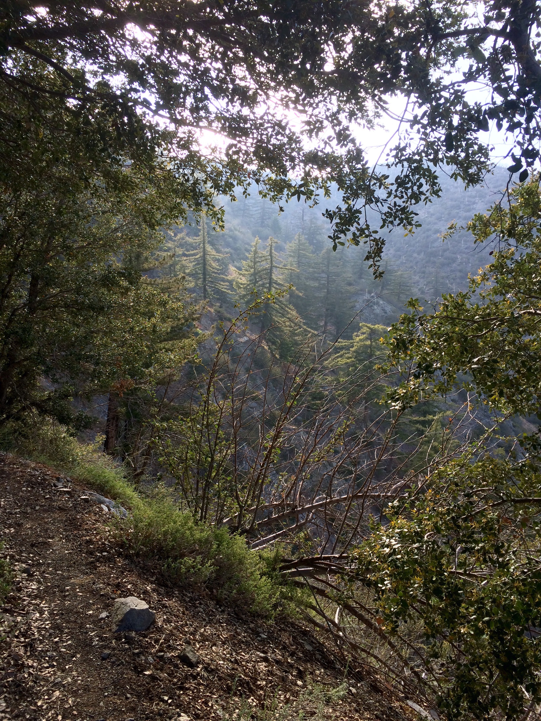
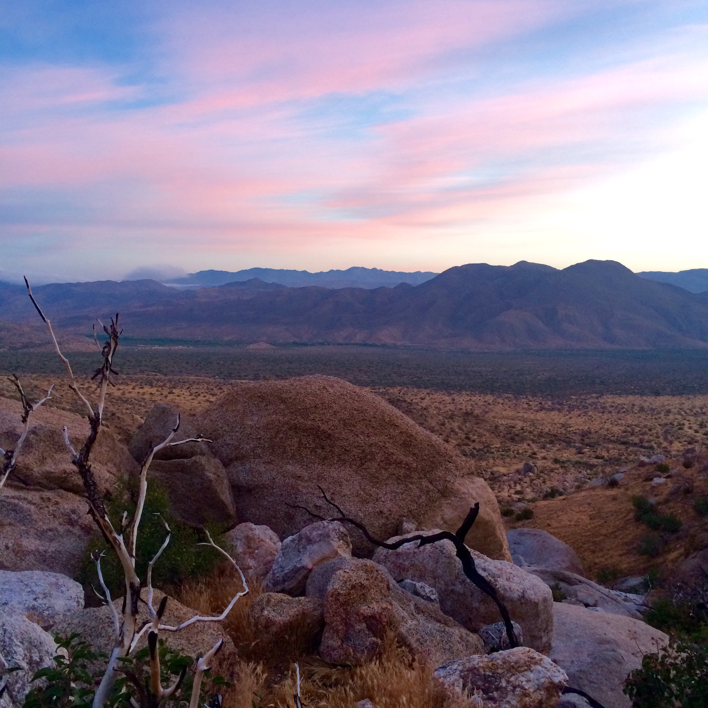
Scenes from Cajon Pass to Wrightwood, miles 342 to 369.5:
Twisting and turning with the trail, train, and rocks out of Cajon Pass
up above the clouds, San Andreas Fault is right below us
Shin splints: 1) a pain in the leg that is a real pain in the ass; 2) what Comet currently has.
So, a few days ago I learned what shin splints feel like. Correction: I learned what it feels like to hike all day with shin splints. But I’ll back up a little, since it’s been a while since I’ve given an update.
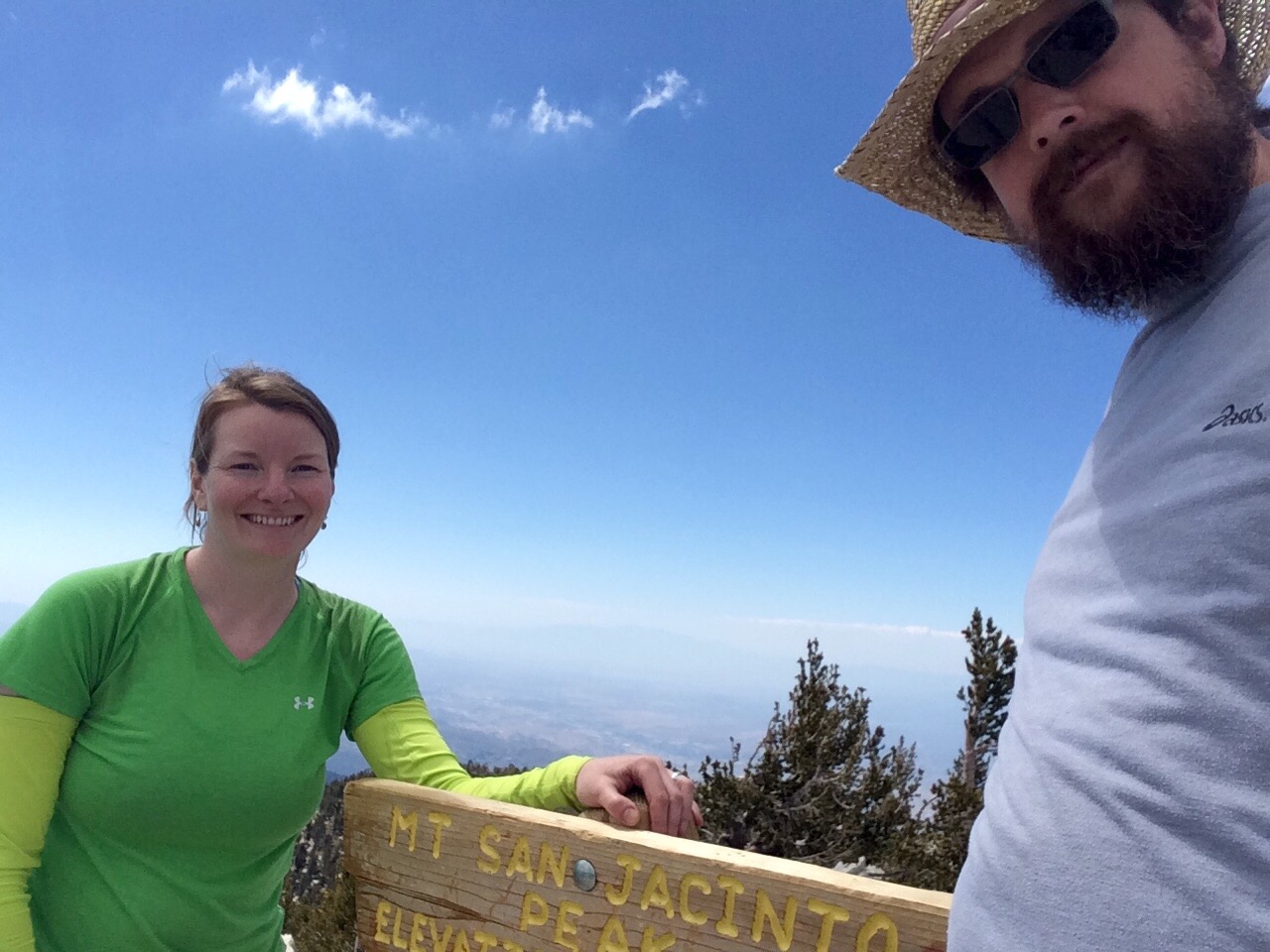
When I last left off, we were spending a zero day in the cute little mountain town of Idyllwild, CA. The next day, we hiked out of town on the Devil’s Slide Trail to meet back up with the PCT. But before that, we decided to take a little detour up to San Jacinto Peak. It only added an extra mile, and the view was definitely worth it! San Jacinto is Southern California’s 2nd tallest peak, which doesn’t sound that special, but at 10,834 feet, it is taller than anything back East and also the 2nd tallest peak we’d ever hiked (Mt. Fuji is the 1st). The elevation made for a slow climb that took us most of the day.
a little cabin near the top, built in the 30s
Not-a-Bear on top of the world
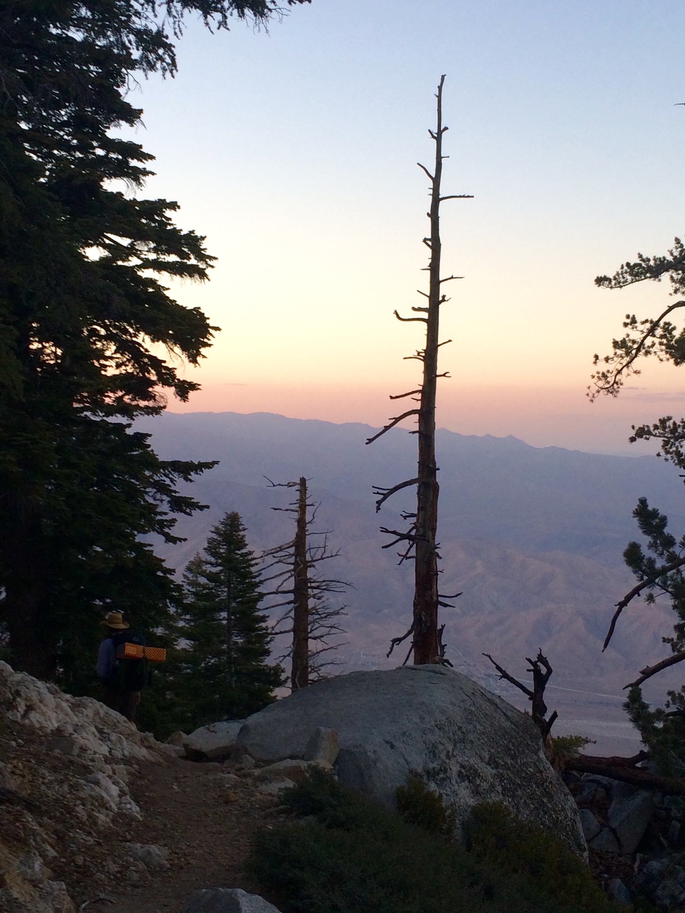
After the peak, we ate dinner by a mountain stream, then pushed on a few more miles as the sun set. This was one of my most favorite moments of the hike so far. After spending all day on the crowded San Jacinto trail, all was quiet and serene back on the PCT. The breeze swirled high above us, but was silent in the trees we hiked through. We watched the sun set below the peaks to our left, and the moon rise above the peak to our right -just breathtaking. We found a campsite in a little clearing (we’re not sure what made the clearing), just as we turned our headlamps on. A pretty peaceful night, other than hearing a mysterious buzzing sound when we pressed our ears to the ground in our sleeping bags, like underground bees.
sunset coming down off San Jacinto
and on our other side, moonrise
Jason hidden in dusk
Luckily, we didn’t see any bees, and started the next day going down, down, down. Sixteen miles of down to be precise, coming off San Jacinto and back into the desert valley below. It was a hard day, but the gorgeous views made it a little easier. We also had a pleasant surprise waiting for us down below -fresh avocados and oranges left by a trail angel, under a shade tent he’d created, at our water resupply (a faucet coming from the town’s water district).
morning in the valley
San Jacinto & our water supply
We had a couple nice days in the valley, one with trail angel’s Ziggy and the Bear -that offered showers, port-a-potties, food resupply, and pizza delivery – another following a stream, with actual water in it! We also got to camp at a campground with flush toilets, running water and soap, and an old trout pond they let you soak your feet in -heavenly!
We climbed slowly back out of the valley, and Days 18 and 19 were spent back in the beautiful pine forest and mountains, which I enjoy much more than the desert floor! These two days were gorgeous, and I was feeling great, starting to feel like an actual thru hiker even!
Day 18 was our second 20+mile day (21). It was one of my favorite hiking days, but also the day my shin really started hurting me. The rest of my body, however, has been quite happy, not as sore, not as tired, just a general hiker happiness setting in that I hadn’t had previously. But Day 19, only 10 miles into Big Bear Lake, although that hiker happiness continued, the shin splints worsened, and those last couple miles into town were the hardest I’ve done so far.
pleasant pops of color everywhere
San Gorgonio & a wildfire in the distance, watching planes dump water on it all day, contained to 10 acres
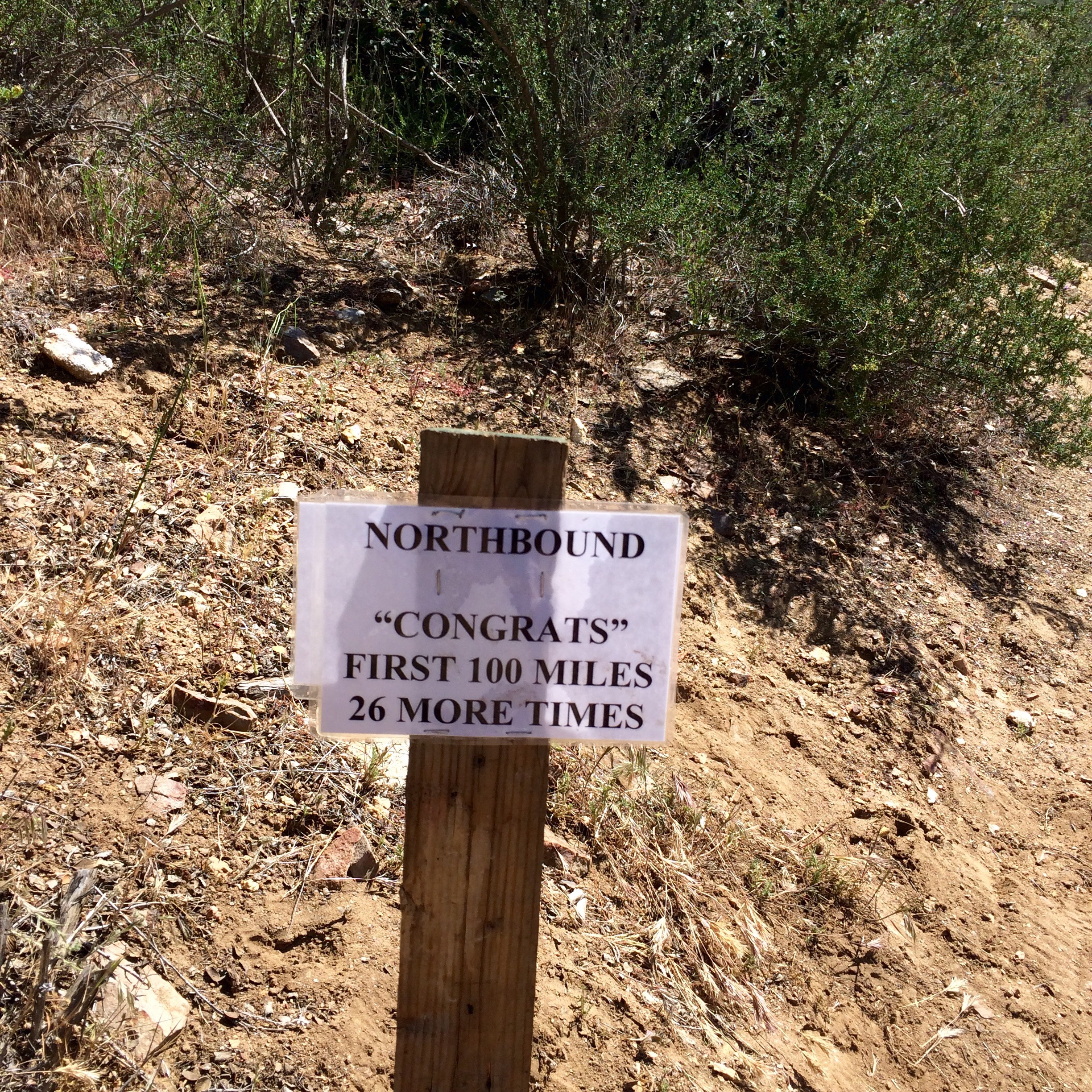
So, after a zero day, not much relief on my shin (just my right leg, which is also the leg I had my ACL surgery on last year, so it makes sense this weaker leg wasn’t in as good shape, and was perhaps compensating in places for other places). Then we took another zero day and realized we had a decision to make, and lots of questions -would I continue? could I continue? how long a rest does my leg need? does it even need a rest? would Jason rest with me or continue on?
These were tough questions for us with no right answers (my least favorite question!), but we finally came up with one that felt like the best choice. My shin needs more time to heal, so that it does not become a long-standing issue. We can’t stay in Big Bear Lake forever. I wanted Jason to continue on without me to maintain the timeline we are currently on. In the grand scheme of things, when I make it to Canada, I will still feel like I accomplished what I set out to, even if I have to miss these next 100 miles. (Although Jason says he is willing to come back at the end and hike them with me if I feel like I need to make it official). Then when I meet back up with him, we won’t feel the pressure of making big miles to play catch up. We also won’t be that far behind the hikers we’d started with and have come to know and enjoy the company of, which was also important to me.
So, I took a bus, and then a train, back to Irvine, to where we started, at my brother and sister-in-laws, whom I’m so grateful to have, not just because they are graciously letting me crash in their apartment, but also for their support and great company.
Sometimes going wherever it leads is not always the place you wanted or thought you’d go, but it is still part of the journey. Having these last few days off the trail to indulge in showers, cupcakes, and trash TV has honestly made me miss it even more, and the time off has made me more determined than ever to get back out there and finish that trail!
my walk today by a man-made lake in Irvine, a little surreal
My leg is starting to feel better, and I have a physical therapy appointment in a couple days to get my alignment checked out to make sure I’m not walking in a way that will cause them to recur. And I also get to help my little brother celebrate his 31st birthday tomorrow!
still calorie-loading on my break 🙂
Jason is also doing well on the trail by himself, making great miles. It’s hard to be apart, but the break will give us new things to talk about 🙂
This is going to be a quick post because the internet connection isn’t great and I want to go back to enjoying our zero day.
Since I last left off we have done another 50 miles, this time in two days. Needless to say we are enjoying our day off – napping, eating (fresh fruit, lots of juice and water and junk food), laundry, showers and resupplying.
Two days ago we did a 22 mile-day, which tested my body and mind in ways it had never been tested. Then the following day, in order to get to our next water resupply, which happened to also be a restaurant and our hitch into town, we pulled another 15 trail miles + 1 off-trail mile (which Jason says doesn’t count, but it does in my book!).
That was our roughest day. The heat (temp around 90), paired with already being tired from our long previous day made for a very challenging walk.
There is now a group of us hiking similar mileage that we have been camping with and leap-frogging on the trail. It makes things a lot easier to have the support and understanding of a group of people all in it together. In fact, everyone, hikers, trail angels and strangers in town have been so friendly and supportive.
Today is very nice. Idyllwild is a cute little tourist town tucked into the San Jacinto Mountains. We are enjoying recuperating here. Tomorrow back to the adventure!
We love reading your comments on the blog, thanks for all your support. Just remember, if you comment on Facebook I can’t see it.
Personal messages:
Kate: you asked if I would still pick up trash in the trail, the answer is yes, only if my pack’s not too heavy to bend over and it’s very small. Although the other day I packed out a Mylar balloon decorated with Disney characters, yet another way Disney princesses are destroying the world.
Mom, I’m seeing lots of feathers along the trail, especially when it gets tough.
Over and out,
Comet
prairie before Warner Springs
the magic if Mike’s Place. what a surprise to get free burgers and potato salad in the middle of the desert! another awesome trail angel
us after our 22 mile day, sunset, happy and hungry
Yes, the rumors were true – there is free pie in Julian! We had been hearing about it for the last few days. I didn’t want to get my hopes up, but there it was waiting for us at Mom’s Pie House, with ice cream and hot tea!
This made an excellent start to our breakfast. Then we headed across the street to Julian Cafe for the prime rib and eggs special.
and I almost finished it!
I think my hiker hunger is beginning to kick in! I started dreaming about hiking and also about meat. Now some of that is probably because we’ve been too cold and rainy the last two nights to cook a proper meal and had peanut butter in tortillas for dinner.
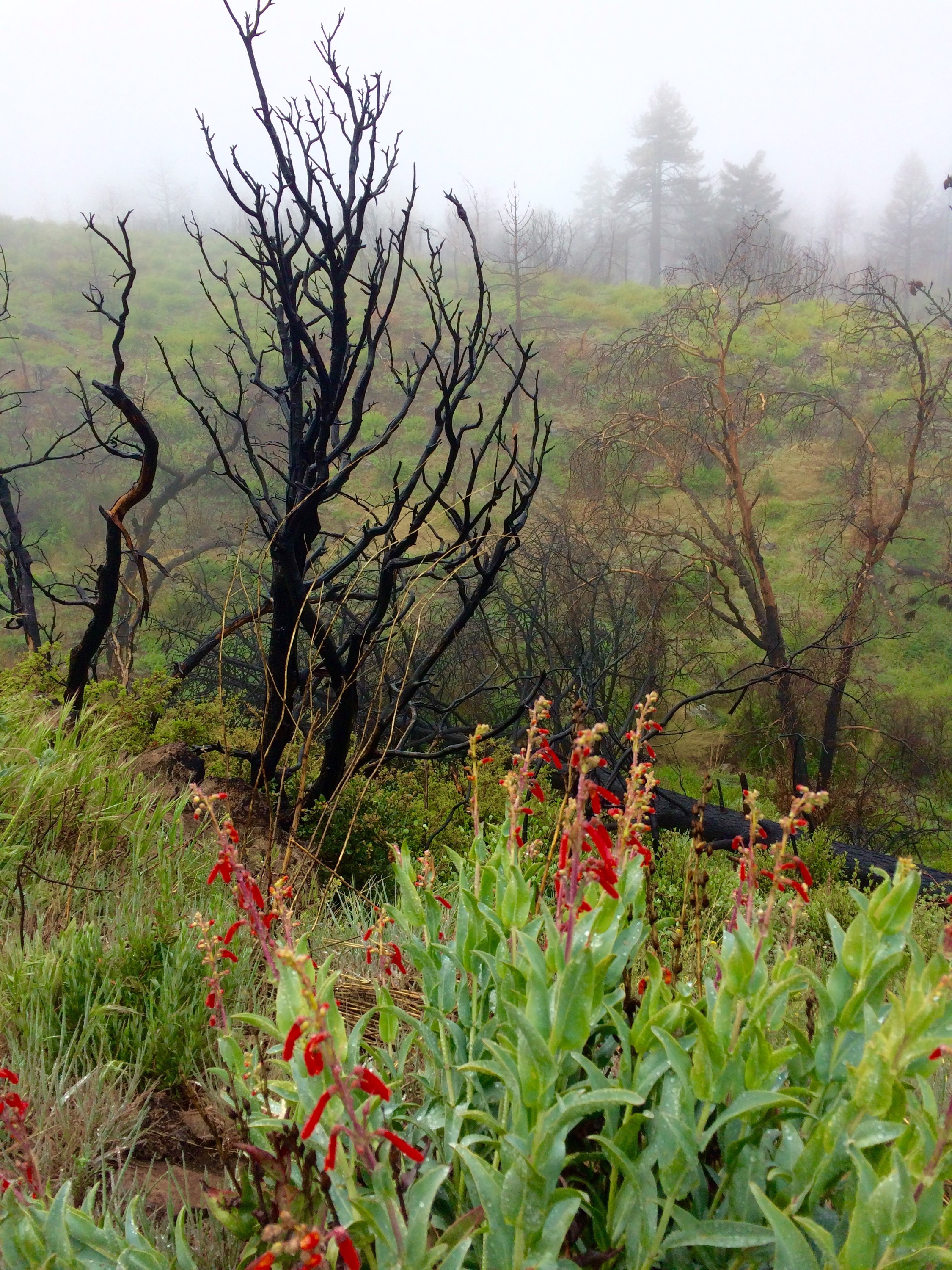
So, apparently every once in a while it rains in the desert, and we happened to catch both days of it this year. it was quite cold, windy, and wet days 6 and 7, but also quite beautiful.
pine cones keep getting bigger
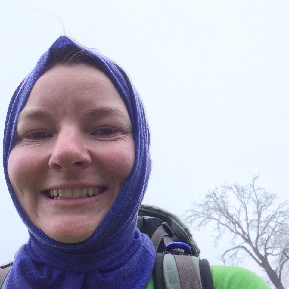
keeping warm in my favorite piece of gear, my buff
misty morning, day 6
rainbow in the desert!
weather finally broke, sunrise day 8
The next two days the heat picked up a bit. More desert hiking, a slow day coming out of Julian. My blisters healed but my body is still adjusting to all this walking. We camped at a nice little campground in the valley, shade, trees, and water.
This morning was a pretty little hike alternating through prairie and trees into the small town of Warner Springs. The community center is set up to help hikers out. $6 for shower with shampoo and towels! $8 and they’ll do your laundry. Yes, please. Free cookies; and hikers working on repacking packs with food from their mail drops, most of us packed too much food, mingling with local artists workings on watercolors. Very relaxing afternoon.
So we are just hanging out, waiting for our laundry a we’ll probably get a few more miles in tonight if the laundry is done soon.
A zero is a day that you don’t put any miles in, a day off. Today we took a zero day, or I should say my feet did.
After settling in at the Mt. Laguna Lodge, getting cleaned up and rested, I realized just how bad my feet had gotten. We got some good advice at the outfitter on how to treat them and that a day of rest was a really good idea for them. It was frustrating since the rest of my body is feeling really good, but I know now it was a good call.
I have to give another huge shoutout to Laguna Mountain Sports & Supply, this time to Mary, who fitted me with proper fitting shoes and comfy socks and gave great advice on continuing the hike with blister management.
Kind of a classic newbie mistake, a combination of too-small shoes, bad socks, and not paying close enough attention to my feet’s needs. But feeling better already and will be trail-ready tomorrow.
out with the old, in with the new. traded up from a size 7 to an 8, where i should have been all along
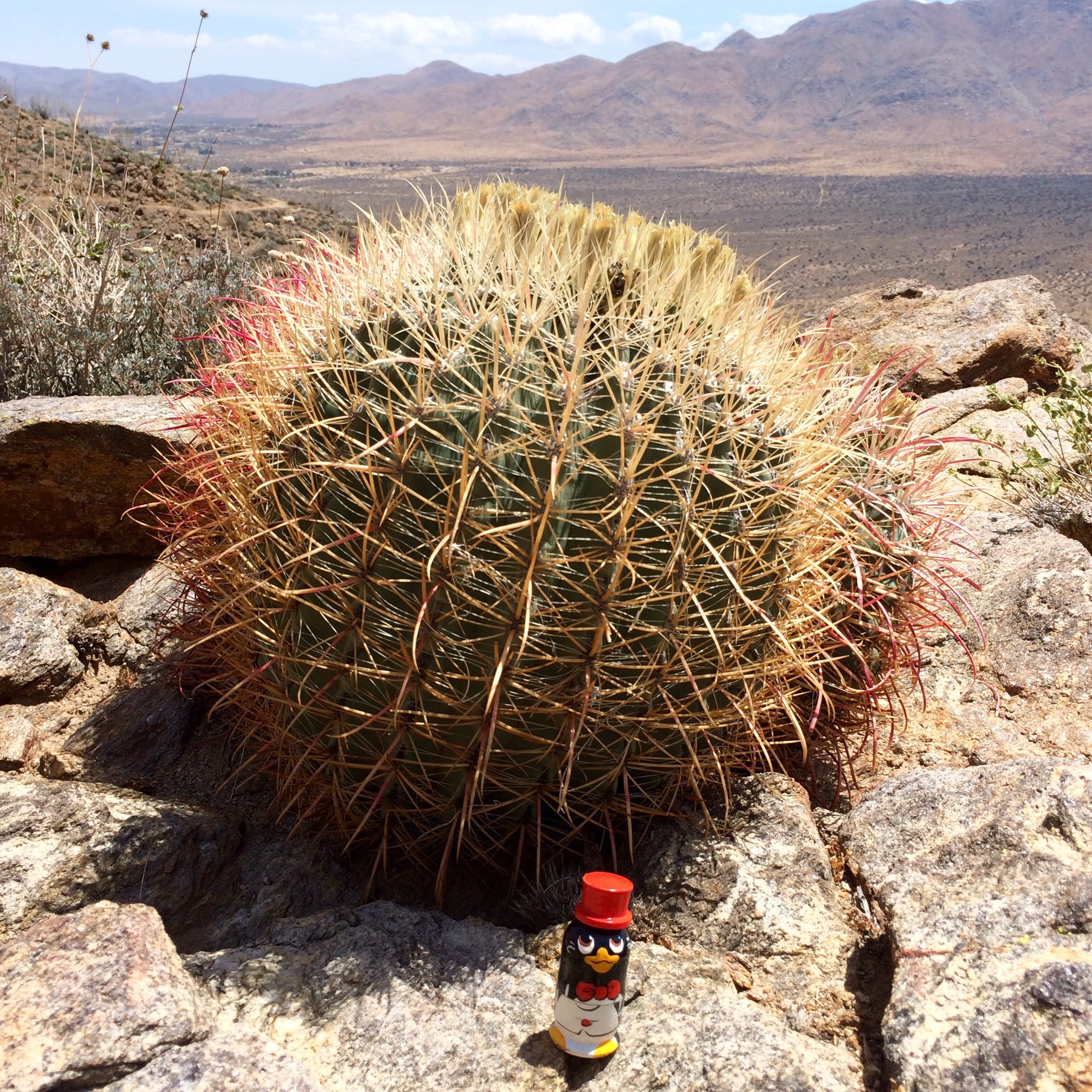
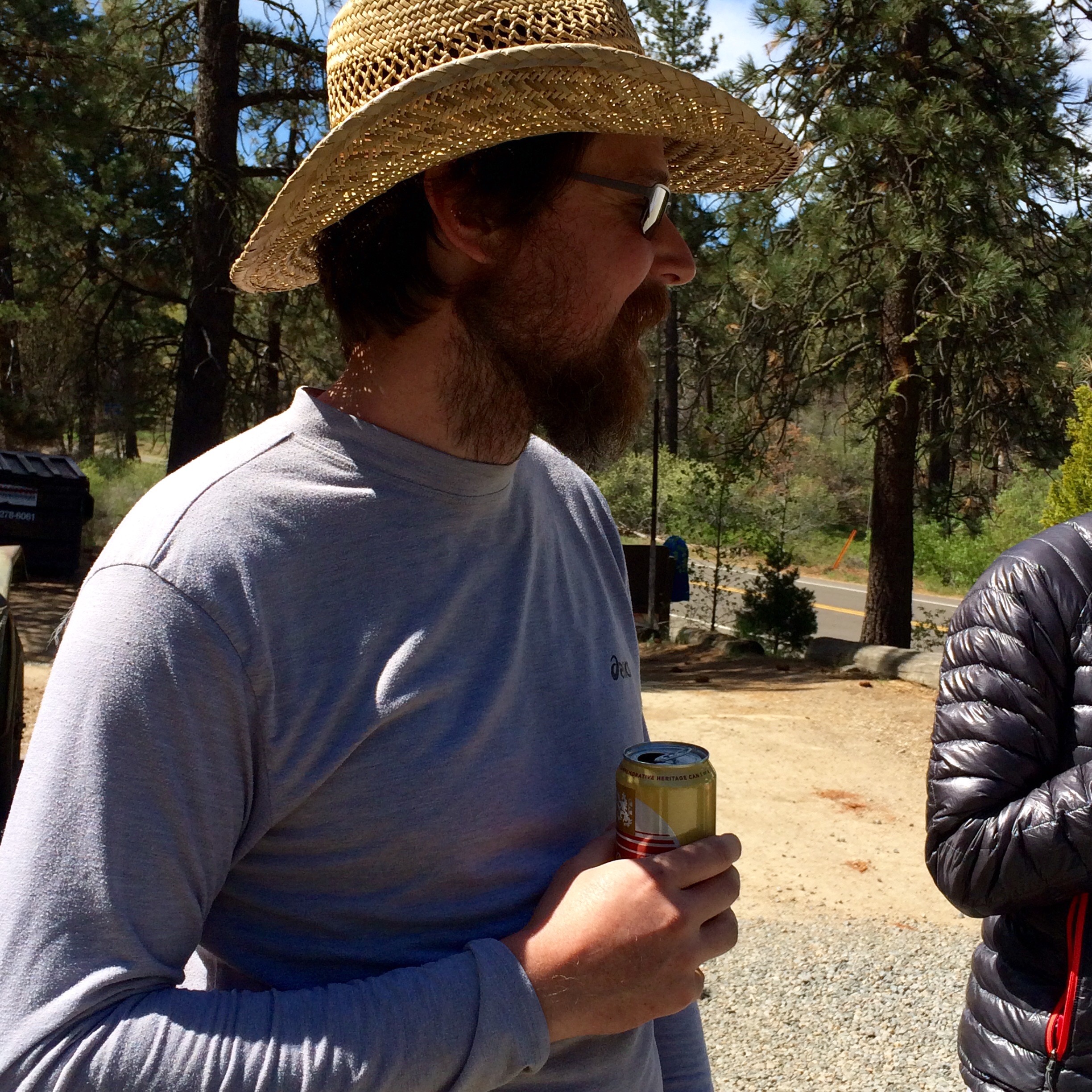
Bear or Not a Bear?
So yesterday Jason got a trail name too. This blog is officially becoming TMI (too much information), and will probably remain that way, since the topics of thought and conversation are quite different out here. You know the saying, “Does a bear shit in the woods?” Well, Jason has managed to pull off not doing this so far, having good timing with campgrounds and other real toilets. Hence, he is not a bear.
Not-a-Bear enjoying some trail magic
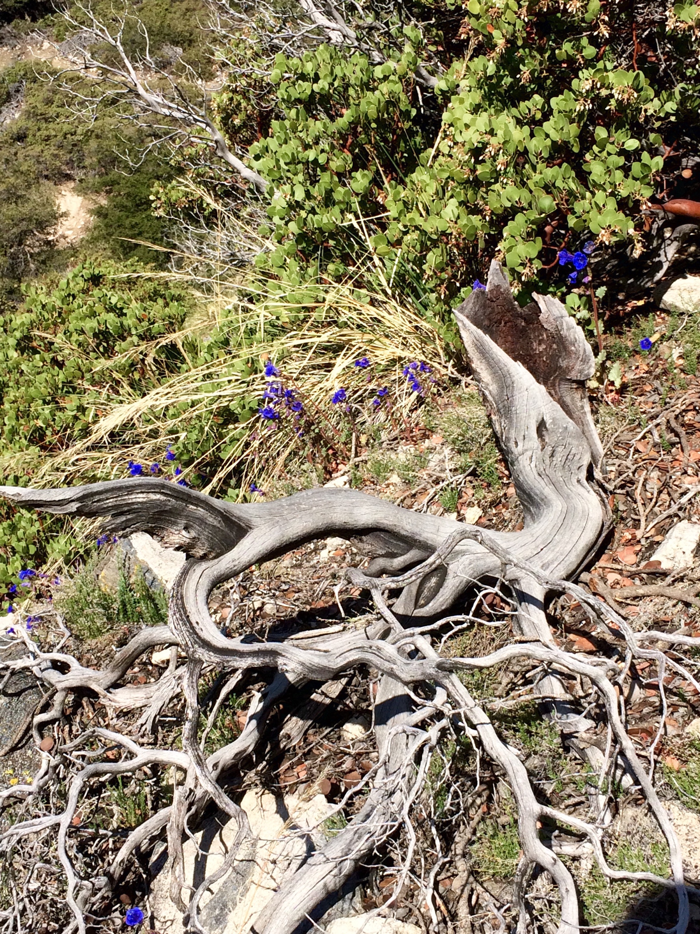
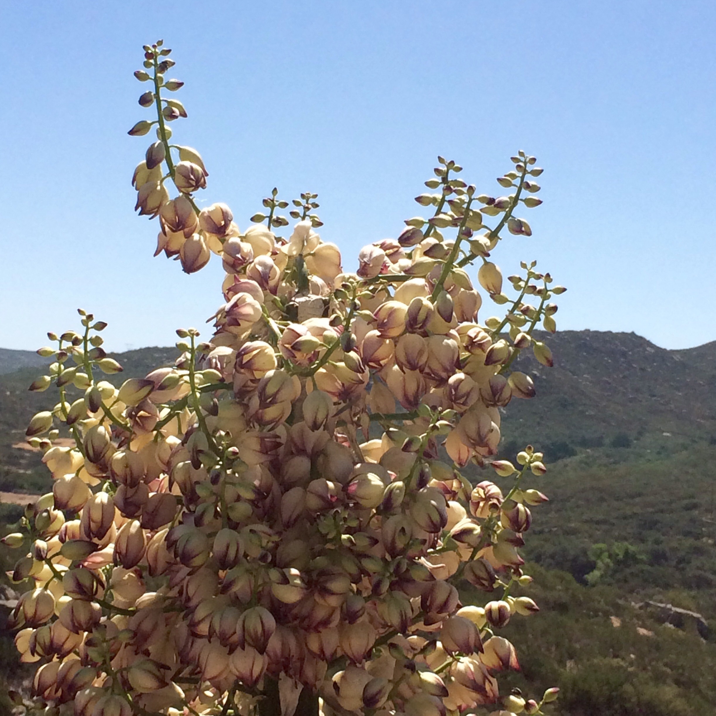
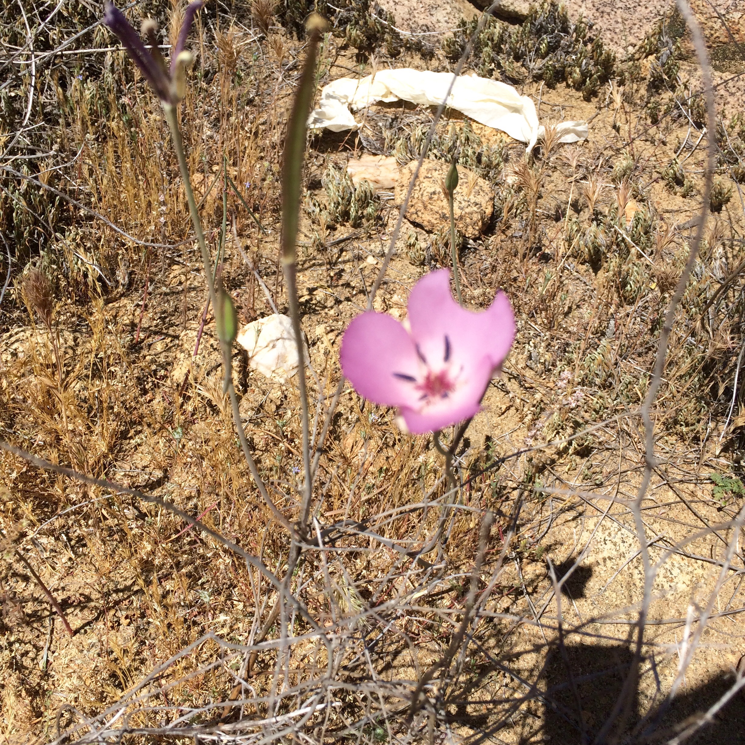
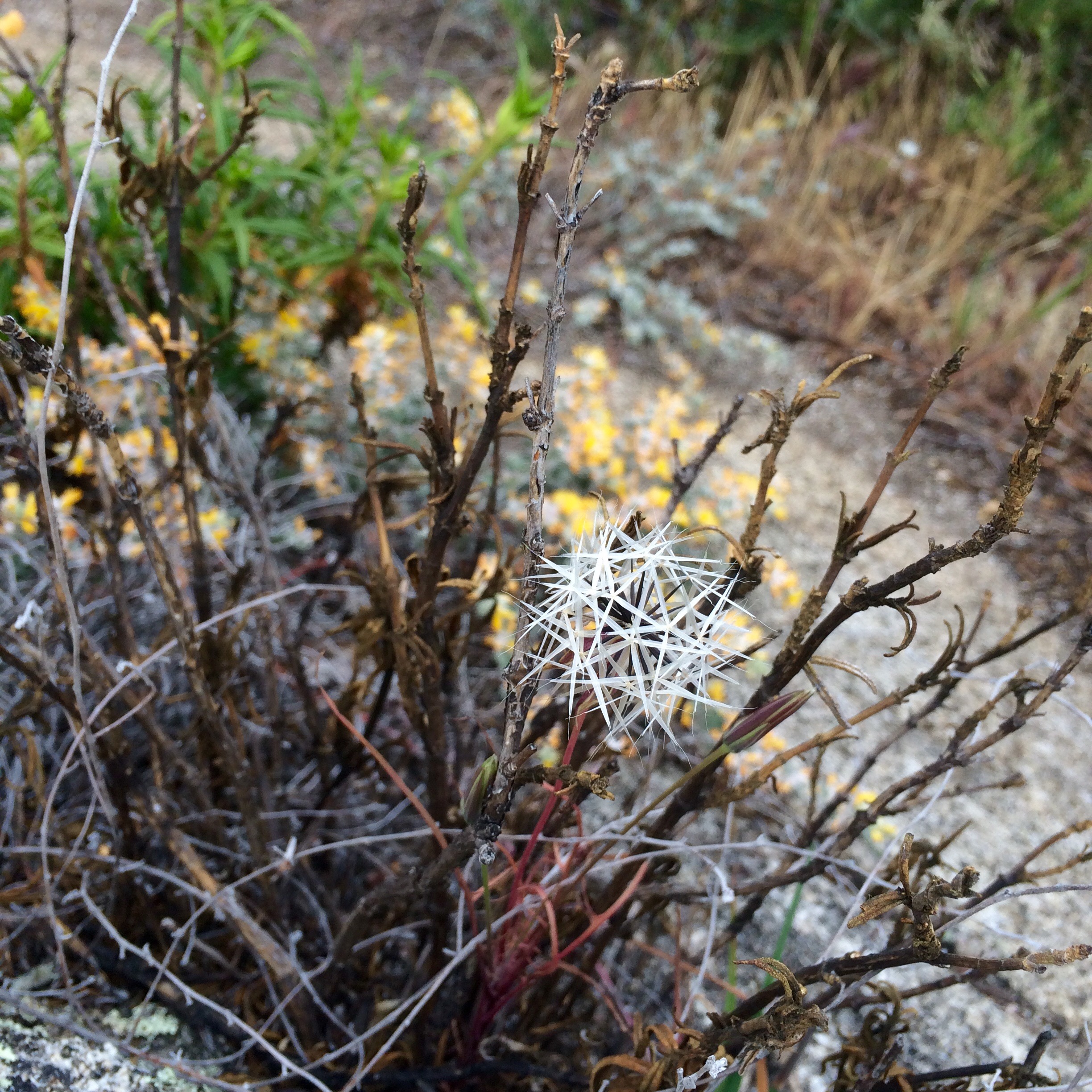
Desert Blooms
And I will leave you with some more pictures. Don’t worry, no gory pics of the feet, just some of the many wildflowers we are finding along the trail.
The blossoms are my many little lovely surprises along the way that keep me going. That and the two main songs I have in my head to keep a good hiking rhythm, “Stayin’ Alive” and “I Will Survive ” (a mix of Diana Ross’s and Cake’s versions).
If anyone knows thenames of any of the flowers, tell us in the comments.
Restfully Yours,
Comet and Not-a-Bear
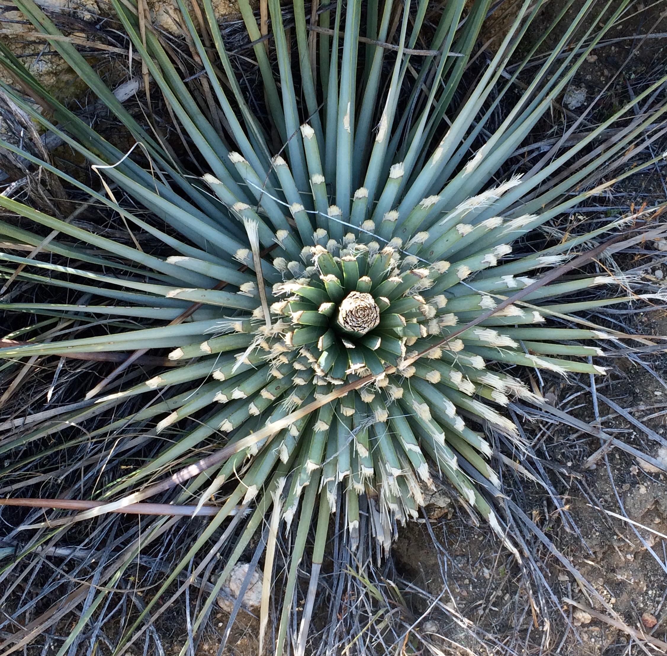
yucca
yucca up close
look like mini poppies
yellow mini poppies?
not actually a flower, but reminiscient of one, a cut yucca plant
at 6,000 feet , surprised by some lupines, feels like home
Where to begin? 4 days and 40 miles in and it’s already been harder, easier, and more wonderful than I imagined!
Prehike Wrap Up
Entering Oregon through the Columbia River Gorge we were greeted by rainbows and sunshine, a good omen as we stopped at Bridge of the Gods in Cascade Locks to check out the PCT for the first time. We then spent a few lovely days unloading our car and visiting friends and family.
Friday we flew into Orange County to visit my brother and sister-in-law. They gave us a wonderful send off- a sunset dinner by the ocean and a champagne toast.
Terry dropped us off at the trailhead around 9 am on Sunday and we hit the trail, after we waited our turn for a photo at the monument.
Day 1
It was a hot one! With a late start we were hiking in the heat of the day. I got a little dehydrated and my Irish body learned some valuable lessons about being in the sun all day.
And I got my trail name: Comet, because I puked my lunch up like I was riding a vomit comet at the county fair. I like the name; it’s unique and humbling. But I’m no stranger to the puke and rally, way back to high school track days.
A tough first day, but we managed 10.6 miles and found a nice spot to pitch a tent barely off the trail.
Day 2:
Another day in the desert and a 7 am start found us at Lake Morena, after 8.8 miles. We covered that by midday and I enjoyed a nap under a tree and rested my newly blistered feet. I have blisters in places I didn’t even know you could get blisters, but it’s all part of the process of toughening up my feet.
Day 3
Our big miles day! Up at 5, hit the trail by 6 and covered 10 miles by noon, enjoyed a cooler morning under a little cloud cover. Pulled in 7.5 more miles after a water refill stop, totaling 17.5 for the day! Camped by a small creek at 6,000 feet elevation for a chilly night but cozy in our down sleeping bags.
Day 4
Only 4 miles to a nice breakfast at Mt. Laguna Tavern and a feet -resting day, laundry in the tub, and showers at Mt. Laguna Lodge.
That’s about all I’ve got energy to write for now. Meeting lots of really nice people along the way and a big shoutout to Mt. Laguna Outfitters for providing lots of great tips for our packs, and new pants for me, since I’d already split a hole in the old ones I brought with me.
And now what you’ve all been waiting for, pictures!
Over and out,
Comet
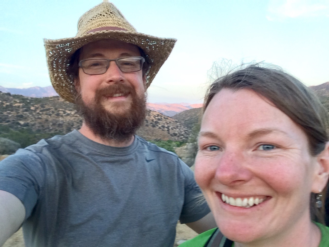
champagne toast with our new friends
Dusty enjoying our lunchtime view, will regret this lunch an hour later
desert sunrise day 2
bird greeting the day with us
day 3, yes sometimes it’s cloudy in the desert
This.
and this. Jason had heard a military plane once crashed in the area and they couldnt be sure they cleaned it all up
Update: This post was written last night, we have arrived! But I’m too tired to update anything else 🙂
So, we are 8 days into our roadtrip with 1 to go! Here’s the short version of what our days looked like: Day 1: Merrimack, NH to Erie, PA (We took several days to meander from Kingfield to MA visiting friends and family, so we didn’t count that as part of the trip)
us in our very packed-down Corrolla, starting out
Day 2: Erie, PA to St. Ignace, MI
Day 3: St. Ignace, MI to Appleton, WI
Day 4: Appleton, WI to Wall, SD (our longest drive)
Day 5: Wall, SD to Badlands National Park, SD (our shortest drive)
Day 6: Badlands to Billings, MT
Day 7: Billings, MT to Yellowstone National Park, WY
Day 8: Yellowstone to Boardman, OR (our second longest day of driving, crossed 5 states)
Day 9 (yet to come): Boardman, OR to Oakridge, OR, where our stuff and our car will land for the next 5 monthsRather than bore you with details of the road, here’s a list of what we found interesting and not. Sorry to the states that didn’t get mentioned highly. I’m sure you all have beautiful spots; we just did not see them on I-90. For example:
Most boring state to drive through: Minnesota, which was one of my favorites when I drove through it on Route 2, but I-90 goes through pretty boring farmlands with no rest stops along the way.
Most interesting state to drive through: Montana -so gorgeous at every turn with the white-capped Rockies in the distance, rolling rangeland, buttes, and mesas. There was lots to look at as well as the most fun driving, with all its twists and turns, inclines, and declines. This is where we passed through the Continental Divide. And hardly any other cars on the road.
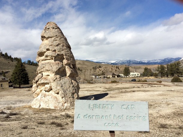
Place we took the most pictures: Badlands gets first place; Mammoth Hot Springs, in Yellowstone takes second.
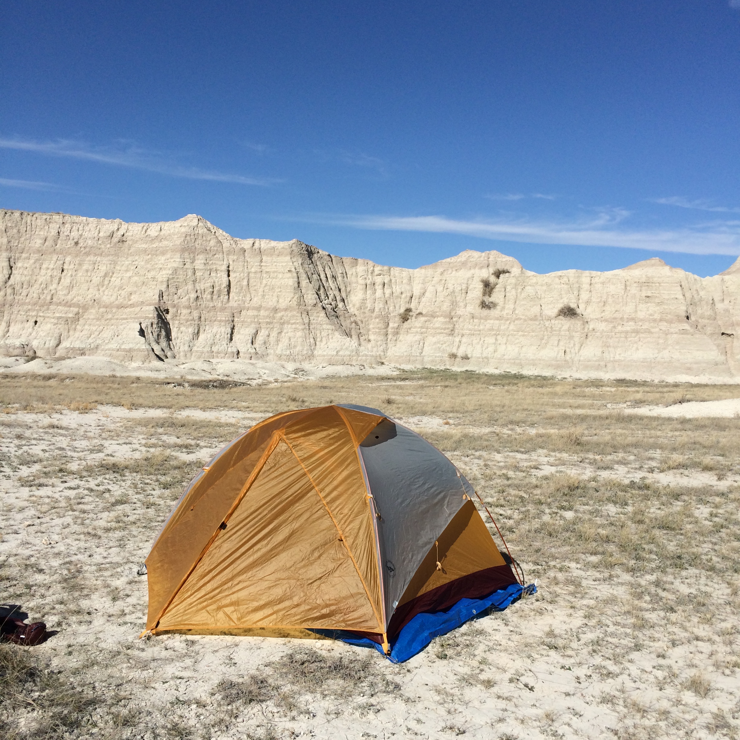
Badlands National Park, South Dakota
our backcountry campsite in the Badlands
Place we took the least pictures: Mt. Rushmore; once you see it, you’ve seen it, and can check it off the list and move on.
Best roadside stops: Again, Montana wins. It had the best and biggest truck stops. Although Al’s Oasis in South Dakota was pretty fun too. And I enjoyed the cheese/gift shops of Wisconsin.
Worst roadside stops: New York; overpriced and generic rest areas on the very long turnpike.
Warmest part of the trip: South Dakota and into Montana on Day 6, got into the 70s.
falls near Lake Superior, cold but beautiful
Coldest part of the trip: The Upper Penninsula, near the Great Lakes, didn’t get above 40 all day.
Friendliest state: Wisconsin; everyone seemed so genuinely kind and happy to see us. Place with the most wildlife: Badlands. These were all the animals we saw: prairie dogs, bison, antelope, deer (white tail and mule), ground owls, blue birds, meadowlarks, killdeer, morning dove, coyote, bighorn sheep. Yellowstone was a close second, where we saw bison, antelope, pronghorn, elk, a bald eagle, rabbits, magpie. We were amazed at the amount of wildlife we encountered in these parks, and how close we got to them. We saw bison scratching themselves on picnic tables, and elk grazing so close to our campsite we could see the mats in their fur. Most surprising animal find were mountain goats at Mt. Rushmore beside all the tourists.
bison in the Badlands
Most played CDs: Grateful Dead, Phish, Tom Petty, and Turner Templeton.
Most frequent car snack: Chocolate bunnies! No, just kidding. (If you missed the bunny saga click on the Instagram feed to the right.) Clementines.
Highest Speed Limit: 80 mph in South Dakota
Favorite place we ate: Jason -Hooch and Blotto’s, in Erie, PA; “purely for the name,” and the food was good too.
Catie -Dobber’s Pasties in the Upper Penninsula
Best craft beer we tried: Big Sky IPA (more points for Montana)
Bottom 3 Worst Moments (in no particular order):
Sharp corners through Cleveland, OH
Crossing the Mississippi into Minnesota in the pouring rain with construction
After Mt. Rushmore, seeing the line of cars waiting to get into Bear Country to see “Cub Fest” (cages bears and their newborn cubs)
Really, it was hard to come up with the worst moments. The trip has been wonderful!
Top 3 Best Moments (in no particular order):
hiking the Badlands
Backpacking in the Badlands, especially spotting the buffalo after scanning the landscape for so long. (Grandpa’s binoculars came in handy), and being able to pick out our own campsite.
Driving into the Badlands and being greeted by two prairie dogs, one on each side of the road, doing that cute thing they do when they stand up.
Driving into Yellowstone, in the first 5 minutes spotting heards of bison, antelope, and elk.
Watching ducks surf the rapids at Boiling River in Yellowstone. We saw several ducks lining up to float the rapids, just like kayakers or white water rafters do. They were just playing, and enjoying the river, warmed by a hot spring.
Tomorrow is our last day, which is a little bittersweet. We are happy to finally arrive at our destination, but a little sad to see this great trip end.Next up on the agenda: visiting friends and family in Oregon, flying down to Orange County to visit with my brother and sister-in-law, then they drop us off at the trailhead on Sunday! So close we can see it in the extended weather forecast! Looks warm 🙂
Happy Trails,
Catie
P.S. Here are some more photos of the trip:
elk, Yellowstone
Mammoth Hot Springs
a terrace of Mammoth Hot Springs
sunset in Yellowstone campsite
magpie
Boiling River, Yellowstone
today
being badass in the Badlands
among the wildlife we saw, some of it was just bones
morning, moonset, Badlands
following buffalo trails instead of human ones, buffalo prints on our morning hike out in Sage Creek
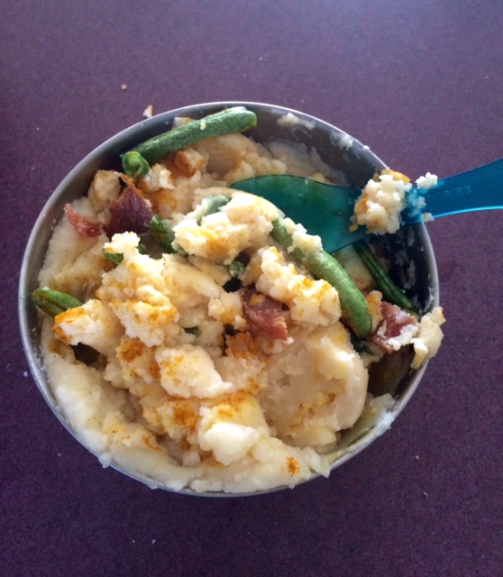
attempting to make instant mashed potatoes a little healthier
This past week, in addition to our usual training at the gym and hiking, we added trying out the food we will be eating on the trail. For the last 5 days, we ate the foods we will be taking with us, and cooked it on our camp stove, even ate it out of our camp bowls with our sporks.
Now, we did not eat as much food as we will be eating on the trail. There is no way we can pack in that many calories with our normal daily activities, no matter how stressful my last week of work got. (Just kidding, it wasn’t that bad.) So, we were just trying out the types of foods, to see what we really liked, what got old fast, etc.
Here’s what I ate:
Breakfast: protein granola bars
Lunch: Cheezits, peanut butter, cheddar cheese
our stove and cook pot
Dinner: instant mashed potatoes most nights, and one night instant mac and cheese, with the following mixed in for variety: turkey jerky, chia seeds, pea protein powder, green food powder (lots of wheatgrass, spirulina, and other veggies), freeze dried green beans
Snacks: freeze dried apples, snap pea crisps, peanut butter
Jason ate a variation of the same, only with beef jerky and bacon jerky (yes, that is a thing, very salty!).
Here’s what I learned:
me eating lunch in my car at work, peanut butter on cheddar, yum!
I still could eat Cheezits every day of the week, but I don’t like them with peanut butter.
I don’t mind a spoonful of peanut butter for a mid-morning snack.
I quite enjoy using slices of cheese as “crackers” for the peanut butter for lunch (Instead of Cheezits, because those are just too delicious to eat with anything else. I may have a problem!)
I much preferred instant mashed potatoes to instant mac and cheese (this may surprise many).
Jerky isn’t so bad mixed in with stuff.
Freeze dried green beans are quite good and soften up in mashed potatoes.
We learned the best technique to stir water into instant mashed in a bowl that it just barely fits into (add a little powder, add a little water, repeat until full).
I did like the taste of the green food powders I was trying out. I’ll get a large bottle of it to divvy out in our food boxes to mail.
mmm, dinner!
It takes about two days for my stomach to adjust to this new diet.
I’m gonna need a lot more snacks!
Another bit of training I’ve done that I haven’t yet mentioned is earning my orienteering badge –learning to use a compass, successfully read and better understand maps, and navigate a trail better. Jason is really an old pro at this, having earned his badge in boy scouts long ago, and can navigate quite well on and off trail in the world.
I, on the other hand, will admit, not so much. But I have successfully learned, I think, we’ll see; or hopefully, we’ll never have to see.
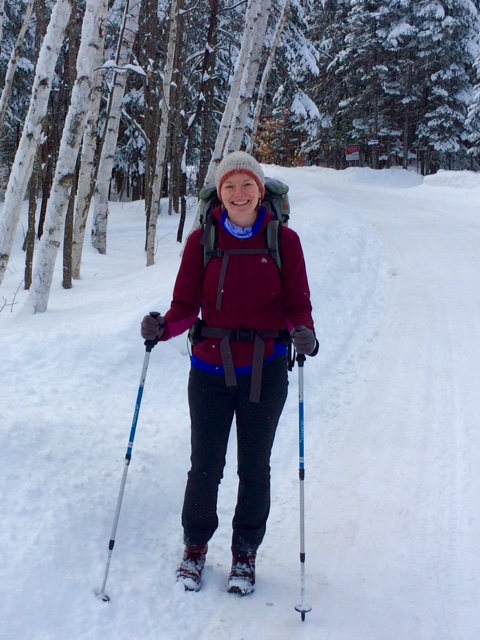
still lots of snow on our last hike! Though it’s finally starting to melt.
So, we have just about everything sold, stored, or packed into our car now. Next week we’ll be hitting the road! We’re driving to Oregon to drop off our car and stuff.
Fun stops we’re looking forward to on our road trip include the Upper Penninsula of Michigan, Badlands of South Dakota, and Mammoth Hot Springs in Yellowstone. Stayed tuned!
Any recommendations of things to see and do, places to eat? We’ll be taking the northern route, a lot of I-90.
See you on the road!
~Catie
Round Top, Belgrade Lakes, Maine. If you look closely, you can see the snow flurries.
You’re doing what on the what? We are thru hiking the Pacific Crest Trail. And if you don’t know what that means, read Part 1 here. Now I’ll continue the FAQ.
walking down to get the mail, practicing with my poles and pack
What’s the highest point on the trail?
Forrester Pass, at 13,153 feet in the Sierra Nevada. We hope to take a side trail to ascend Mt. Whitney, at 14,494 feet elevation, which would make it the highest point of our journey. It is also the highest point in the contiguous United States.
What’s the lowest point on the trail?
Cascade Locks, at 140 feet above sea level, in the Columbia River Gorge in Oregon.
How much will your packs weigh?
The base weight (base weight is everything you are carrying with you, including the weight of your pack, and excluding food and water) of my pack will probably be around 12 pounds. Jason’s will probably be around 15 pounds, because he is carrying the tent, and our cooking stuff. That means the full weight of our packs when we are headed out of resupply points will be me: 35 pounds, Jason: pushing 40 pounds. The further we hike away from resupply points the more food and water we consume; thus, the lighter our packs become.
How many miles a day will you hike?
We need to average about 17 miles per day in order to make it to the end of the trail before the snow falls in Washington. This average includes any zero days we’ll take. A zero day means a rest day; zero miles completed.
At the beginning we’ll start out at about 10 miles a day, slowly building closer to 20. Mileage will also depend on the terrain we’ll be traveling on for the day. We’ll make more miles during flat stretches, less when we are climbing in elevation. Making it to resupply points during post office and store hours is also a factor in how many miles a day we travel, and if we need to do laundry in town, etc.
multi-tasking -training while getting housework done!
How are you training for your hike?
It is the dead of winter right now in Maine, so although we are getting out to do some hiking, weather and work schedule prevent us from doing a lot. It’s pretty tough to simulate hiking miles and miles day after day. They say, the real training begins on Day 1 of the hike. Not until hiking the actual trail, do you really start to get in long-distance hiker shape.
That being said, there are still some things you can do to prepare, which, I feel, are pretty important. I am doing a lot of strength training, focusing on my core and legs. For those of you that don’t know, I tore my ACL last January, and will be about 1 year 1 month post knee surgery when we start the trail. So, for me, building the strength, balance, and confidence back up in my right leg has been very important. Luckily, I am friends with an amazing personal trainer who set me up with an awesome training program I have been doing for the last 10 weeks, increasing in difficulty as I get stronger.
This is what my weekly exercise plan looks like. Actually, this would be an ideal week, which hardly ever happens.
Strength training at the gym or a less intense home program, focusing on core and lower body, with a little upper body thrown in for good measure (2-3 times a week).
Endurance, which, when the weather is good, includes a hike. When it’s not, I spend a long time at the gym doing a combination of slow jogging, swimming, and biking (once a week).
Cardio Intervals. I usually do this on my strength days at the gym, but sometimes just by itself. I will do a combination of running on the track and treadmill (soon, with the extra daylight and warmer temps, I can start running outside again!), or a swim (2-3 times a week).
Rest day, at least once a week, but often, for various reasons, it’s more than that.
What else? We also wear our weighted packs around the house, while doing cooking or cleaning (I actually sweep more now that I’m wearing my pack!), or on walks down to our mailbox. I also have a pretty consistent yoga practice, which includes meditation. Although, I have to admit, since I’m exercising a lot more, some days this takes a back seat.
What has Jason been doing to train? Well, since he’s less schedule-oriented than I am, his training is a little (a lot) less regemented. He wears a heavily-weighted pack while pacing around the house, doing walking lunges, and various other strength exercises, runs on the treadmill a little, and of course, accompanies me on our hikes.
We also spend a lot of evenings reading books and blogs and researching for the journey as well.
Here’s a little more background on what the Pacific Crest Trail is and what we’ll be doing on it. I decided to write it in FAQ style, with questions I’ve been frequently asked; questions I frequently ask myself; and answers to some other interesting questions. Here ya go! (This got a little long, so I split it into two parts.)
Feel free to ask me more in the comments below and I will try to answer them in Part 2!
Note: I am, by far, not an expert on this subject. There are plenty of people who are, and you can find them through Google searches and some of the links provided below, like this one.
What is the Pacific Crest Trail?
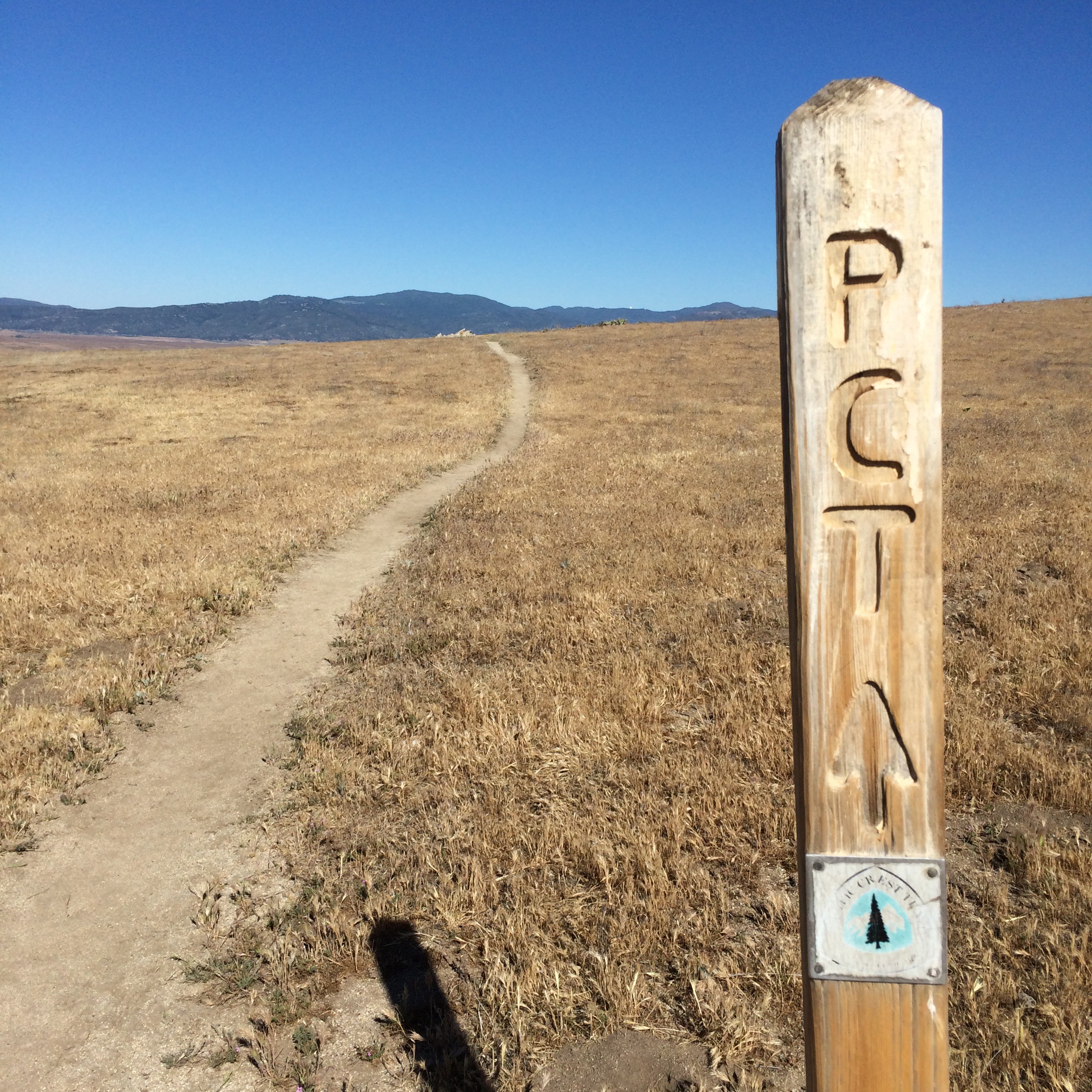
The Pacific Crest Trail, or PCT for short, is a 2,650 mile trail that spans the states of California, Oregon and Washington. It starts at the Mexican border in Campo, CA and ends at the Canadian border in Washington. The trail usually runs along the ridgeline of the mountain ranges of the west coast. In California, it traverses the Laguna Mountains, San Jacinto Mountains, San Bernardino Range, San Gabriel Range, Sierra Nevada and other mountains, across the San Andreas Fault, through a stretch of the Mojave Desert, and parts of Yosemite National Park. Its Oregon section covers the Cascade Range, including Crater Lake, passing through lava fields, and near The Three Sisters Mountains and Mt. Hood. The trail crosses the Columbia River on the Bridge of the Gods going into Washington. In Washington, it climbs out of the Columbia River Gorge, continuing along the Cascades, with a close-up view of Mt. Rainer. The trail ends at the Canadian border, but has been extended for a seven mile stretch into Canada, requiring you to carry a passport to get back into the United States. This allows a quicker connection back to a road.
What is a thru hike?
A thru hike is a hike through an entire long distance trail, such as the PCT, Appalachian Trail, or Continental Divide Trail. It is completed in one entire season, rather than in sections at a time.
How long will it take you?
We are planning on the entire hike taking us between 4 ½ and 5 months. We will start our hike on April 19th and hope to finish sometime in September.
What will you do about food?
There are a few options for food. Typically, we will carry about 4-6 days worth of food in our packs between resupply points. A resupply point is a town, or sometimes only a small convenience store or post office that is off the trail. Resupply points are reached by walking or hitching a ride. Once we reach a resupply point, we will either stock up at a local store or pick up a package we have mailed ourselves ahead of time.
Not all towns along the trail have places to stock up on food, so often post offices and other places will hold packages for thru hikers. Some people put together all of their packages ahead of time and mail them out, or have someone else mail them as they go. We are choosing to resupply in town whenever we can, and do a few package drops that we mail ourselves along the way for more remote areas.
As for what we will eat, we have put together meal ideas that include highly calorie-dense foods that either do not require cooking, or are cooked quickly. Any “cooking” we do will be merely boiling water for instant foods on a little canister stove.
A sample menu for the day may look like this:
resting our packs during a lunch break on a recent training hike in snowy Maine
Breakfast: Protein bars or oatmeal
Lunch: Cheezits, peanut butter, cheese, pepperoni
Dinner: Instant mashed potatoes or instant mac and cheese with beef jerky, dried vegetables, and powdered milk mixed in
Snacks: bars, nuts, dried fruit, crackers
I also plan on carrying a good multi-vitamin, and spirulina powder and chia seeds to mix into things like oatmeal and instant potatoes for added nutrients.
And of course when we get into towns, we’ll pig out on whatever we want!
What will you do about water?
We are carrying a Sawyer Mini water filter to filter our water from streams, springs, etc. In the desert, we will often carry large amounts of water with us at a time, since water sources will be few and far between. We will also have iodine tablets as a back-up water treatment.
What about snakes, spiders, scorpions, bears, and crazy people?
These are all things one may encounter on the trail. Except for crazy people; that is a myth. As for the other creatures, they are typically not things you have to spend a lot of time worrying about. From my polling of many fellow hikers during my time in Arizona, I learned that rattle snakes never bite people unless you are drunk, or stupid; i.e. unless you provoke them. They do have a rattle that will warn you ahead of time, and you simply stay out of their way. They really want nothing to do with you.
The same goes for the other poisonous critters. You just watch out for them. Don’t put your hands in holes. Don’t put your feet in your shoes without checking.
Bears, again, typically want to leave you alone. You want to be cautious about protecting your food at night by hanging it or keeping it in a bear canister. In a portion of the trail through Yosemite, bear canisters are required.
trying out a tent at REI, not the one we got, a little too small, a little too expensive
Where will you sleep?
We have a light-weight tent Jason will be carrying and light-weight down sleeping bags. Mine is rated for 11 degrees, mainly because I get cold easily, but also at higher elevations like the Sierra, it could get below freezing at night.
On the trail, we will tent out at a combination of established camp sites, and wherever looks flat.
We’ll occasionally stay off the trail in places with actual beds, where we can also take showers, including hiker hostels, cheap motels, a couple splurgy hotels or resorts, and maybe with trail angels, and friends along the way.
What’s a trail angel?
A trail angel is someone who lives near the trail and helps out thru hikers, doing anything from giving them food, to a ride, to a place to stay, or maybe just words of encouragement.
Any other questions I should include in Part 2 next week? Jot them in the comments or shoot me an email.
Happy Trails,
Catie
Update (11/20/17): Wow, reading over that sample menu made me laugh! We ditched our stove and instant mashed potatoes (along with bear spray and other “essentials”) a couple weeks into the hike and never looked back! It made me realize how much you learn as you go on the trail. But reading good resources and thinking about pre-trip planning is helpful. Here’s another resource you might check out: Pacific Crest Trail 101, a good overview of the trail and things to think about as you start planning. But as always, you’ll have to hike your own hike.
So how did we come upon this crazy idea of ours to thru hike the Pacific Crest Trail? When we finally realized it was crazy not to.
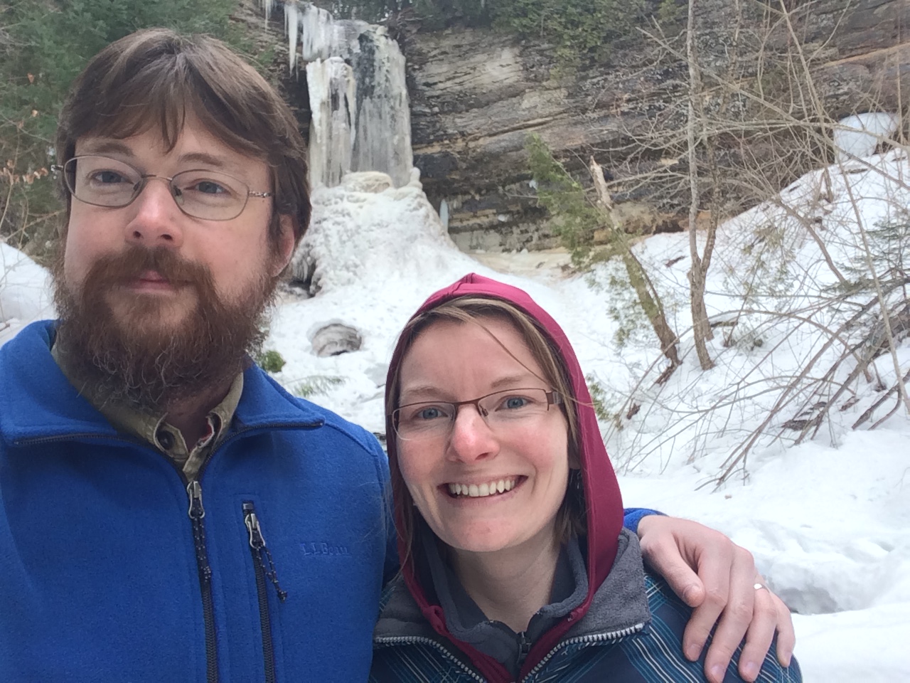
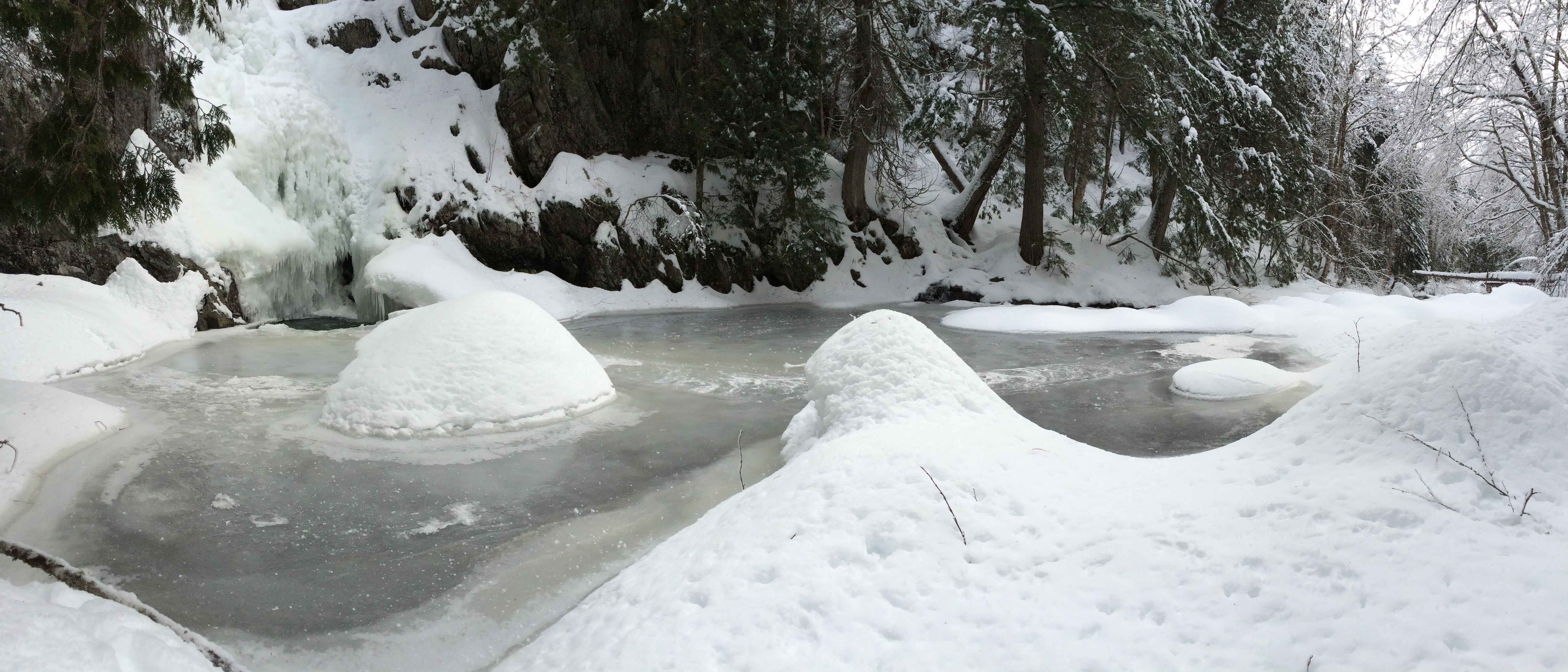
A little bit before Christmas, we headed out into the woods to get away from the world, as we often do. We were heading to the falls we got married at. We hadn’t done this trail since that day, when we hiked in as boyfriend and girlfriend, and out as husband and wife. On this winter day, we reminisced about the wedding, and talked of how much had changed in the surroundings. The trail and falls looked completely different, covered in snow and ice, than they did five short months ago on that sunny summer day. Everything was different.
Poplar Stream Falls, winter
We began to talk about what we wanted our life to look like, which often begins with wild and crazy ideas, then narrows to more realistic (and boring) ones. We’d been talking about moving, either back to Portland (Maine) or to the west coast. Jason joked that we should walk to wherever we move instead of drive, and we got caught up in this fantasy of walking across the country. This has been our go-to fantasy when our jobs are feeling really tough, and we want an escape. At some point on our way back on the groomed snow trail, I asked aloud, “Well, if this is something we really want to do, why can’t we do it?” (This may have been more of a revelation to me than Jason, who was quicker to jump on board.)
Back home, the fantasy got a little more concrete as we began throwing around ideas of walking for a cause, and researching others who have walked across the country. We discovered it would take a little longer than we maybe wanted to be walking, and the routes weren’t always that scenic.
Then we began to throw around the idea of hiking a long trail. Jason had already hiked the Appalachian Trail, so that was out. It would have to be something new to both of us that we could experience together. I had just read Cheryl Strayed’s Wild (Yes, there, I said it, this wonderful book was, in part, my inspiration), and threw out the idea of the Pacific Crest Trail. We also looked at other trails like the Continental Divide Trail (a little more than I was ready for), or the Pacific Northwest Trail (a little less than we were looking for).
From that night on, our fantasy revolved around the Pacific Crest Trail (PCT, for short). We didn’t commit to any more than just toying around with the idea, but the more we both thought and talked about it, the more excited we became. In an attempt to shake a real answer out of me, Jason began telling me tales of how hard thru hiking is, what it is really like. I think he did this because he really wanted me to say yes to this, but wanted to really make sure I meant it, and wanted it.
I wanted it. The more I thought about it, the more sense it made. And when I say sense, I mean I felt it. It felt so right. During all of the previous thinking and planning out our next steps, ideas of places to move, jobs to apply to, I was riddled with indecision and anxiety. But with this plan, there was none of that. It settled into my brain so snugly, and then stretched out and relaxed there, until we both finally admitted this is what we had to do. We would quit our jobs, spend the summer hiking the Pacific Crest Trail, then stay out west at the end of it and see what will happen next.
I truly believe that one right decision leads to another. All my previous anxiety fell away, because those previous plans were not the right plans. I so strongly believe that if we continue saying yes to what our hearts want out of life, we’ll continue to be led to doors, and more doors we hadn’t even thought of will open up. So far, this has been true. Things are falling into place quite magically.
We also dropped the idea of doing this for some kind of cause –doing this because it is something we want to do in our life is the cause. This is another reason our plan feels so right. Jason and I are both coming to realize, for both separate and similar reasons, that neither of us are that suited for a “normal” life. (Let’s just admit it, neither one of us is that normal.) And I am finally completely ok with that.
This hike, then, is not an escape from “the real world.” This is the real world, lived out how we want to live it, not how convention dictates we should. We are both finally actively figuring out how we fit into the life that we make, rather than trying to fit into lives that society makes for us.
Since this decision, I have settled into feeling like myself in a way I haven’t felt for quite some time now. (It feels so good to be true to yourself.)
I’d like to leave you with one last thought –this lovely piece I came across while making the decision.
In the posts leading up to our hike, I will share what we’re doing to prepare for the hike; why packing and purging for a cross-country move is so liberating; and maybe even a sneak peak of what’s in my backpack (without getting gear-heady!); and what is the PCT anyway?
Stay tuned! Subscribe by email with the button at the bottom and never miss a post!